Saturday, January 28, 2012

Day 438: Rancho Potrero Open Space - Loop to Hidden Pond Trail & Rancho Sierra Vista

Day #438 * Hike #494 * New Track #448Thursday January 26, 2012
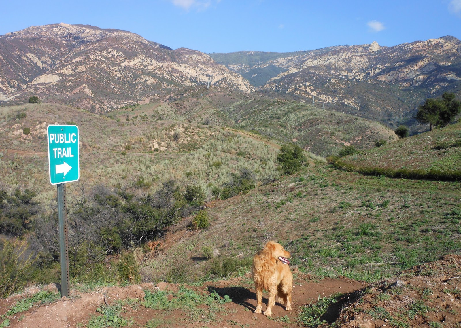
Rancho Potrero Open Space - Newbury Park
Loop to Hidden Pond Trail & Rancho Sierra Vista
My Tripometer: 1.5 Hours * 5.75 Miles * +700 Feet

Today's Trailhead (wrong way)

Directions:
From the 101 Freeway in Newbury Park, exit on Borchard and follow Borchard all the way into Dos Vientos.  Turn right on Rancho Dos Vientos and take this to the end.  Turn right on Lynn Road (becomes Portero Road).  Immediatly on the left you will see a gate; this is where you should park.  However, I rode up a few hundred more feet and parked at this drive in the picture above.  I jumped the fence and began my journey...


 Rancho Potrero Open Space

This map cutout is from the Pt. Mugu State Park Trail Map.  The Rancho Potrero Open Space is located adjacent to the popular Rancho Sierra Vista Park (where most people ascend to climb Boney and view the waterfall).  This was my third visit to the open space.  My mission today was to start from this location and hike west and stay above Potrero road.  However, as you can see by my blue inking and highlighted route, I created a loop back to Rancho Sierra.  The blue is a bit confusing because its the same color the map uses to separate the section.  If you follow close, the route is easy to do...

 Creepy Coyote

Not much more than a quarter mile down the road a fence blocks the dirt road.  A Private Property sign is ample enough warning for me to not continue.  I thought about it and then said, nah.  Guess this will be a short hike...  Maybe I'll come back another time and venture off this way.  I didn't have my park map at the time but after looking at it, this road should lead all the way down to Las Posas Road in Camarillo.  Sooo much open space to explore and not a sole in sight.

Let's head this way 

It looks like a little footpath, but not really.  A moment later, I am tramping over uneven grass.  I kept my eyes open for the coyote.  I had to clear a barbwired fence and then rejoined where I have been before; a cement slab with collapsed wood where a structure once stood.  From here there are a couple narrow single footpaths going up through the grass.  I tried one and within a few moments I joined a road:

The Adventure Begins


 Looking Below -- Amazing Hidden Greenland

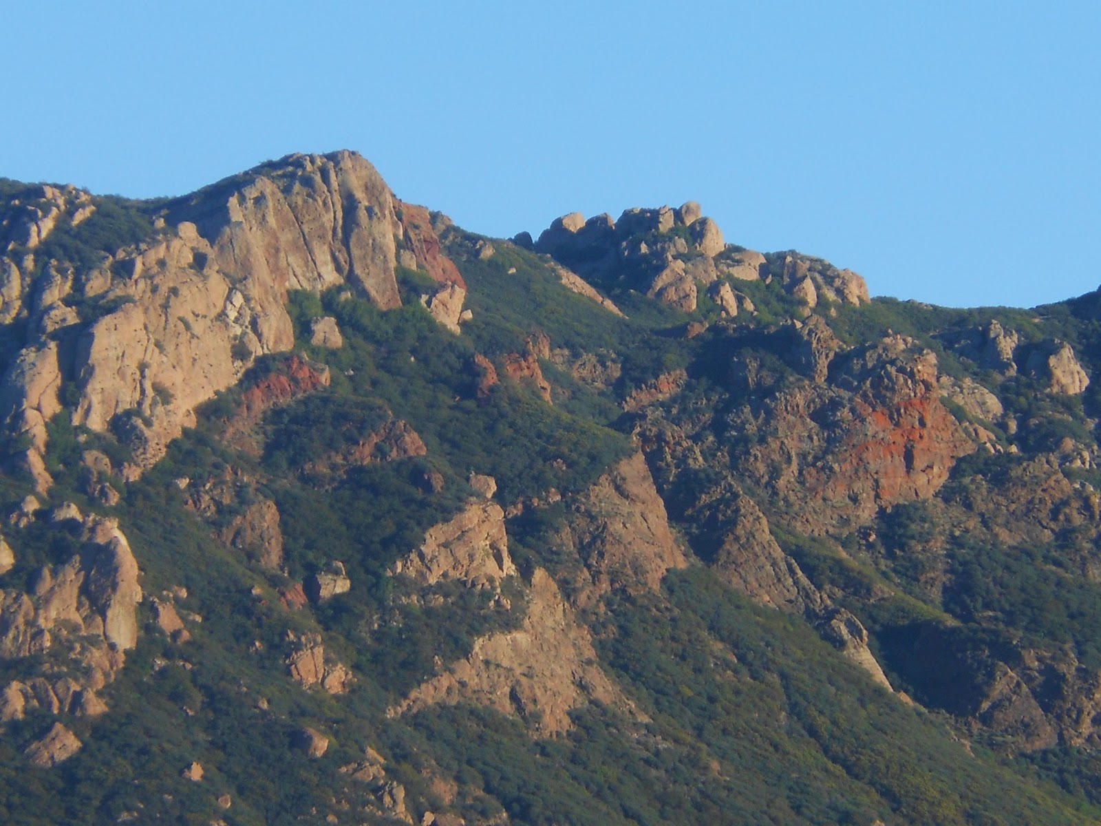
 Boney ahead was shinning

 At the T-Junction on the Valley floor, I turned left...

 Bunny


 The trail continues lower and into the gloomy forest

 It's pleasant in here - you will jump a fence and cross the dry creek

 T-Junction (Hidden Pond Trail); I chose left

 Crossing another dry creek

Confirmation that I was on the Hidden Pond Trail

I located this on the map and if you follow it way out, there is actually a hidden pond back here.  This trail ended at a paved road.  At first I was confused but then realized that I was on the bike trail that goes all the way to Sycamore Canyon Campground in Malibu.  I road my old mountain bike down here nearly a decade ago.  Of course, hmm, which way do I go today?  I chose left...


 Trailhead across the street


 I saw a biker at the bridge, I followed him
(Uphill from here for +400 feet or so)

 Turn left on the Ranch Overlook Trail all the way back...

It was nearly dark by the time I reached the Rancho Sierra Vista area.  Once I climbed to the top and witnessed the open field, I felt safe.  I continued down the cement bike path until I reached the Ranch Overlook Trail.  On the right was Satwiwa Culture Center but no time today for a visit.  From this spot, it's still about 1.5 miles back to my bike.  A slight incline and then across the horse trail.  Eventually, the trail will veer left and back up to a cool hill with trees.  Instead, I cut across to the right on a single track across the grass...

 Sunset

The Proper Trailhead for The Rancho Potrero Open Space

I passed the trailhead where many cars were parked and zoomed back to my bike.  I jogged most of the route today; good workout.  Still much more to explore back here.  Today was great.  Day time temps were in the mid 80's!  It's January --  Love Cali!


Day #437 * Hike #493 * New Track #447Wednesday January 25, 2012
Pilgim Studios & Draft Bar - North Hollywood
My Tripometer: 2 Hours * 1.5 Miles * +25 Feet
Off Laurel Canyon and the 101, Jess and I met up with my sister Julie to apply for another Reality Show.  Scavenger Hunt was the show and I hope we get picked!  That said, I think we botched the interview.  Oh well.  We walked about the streets in this area, and then circled down to a bar "Draft Bar".  They had an interesting Hamburger Taco, which had French Fries in it.  The food was not that great, but the beer is always good.  Jess ordered the loaded potato skins but they came out shriveled up like a granny's A$$.  I ordered the LA Street Dog, it was just ok but the Onion Rings I ordered it with were great!

We rode 150 miles back and forth and around today on the bike.  My butt is still sore.  Great weather though so no complaints...

Thursday, January 26, 2012

Day 434-436: Jesusit & Arroyo Burro Trails // Shoemaker Brothers, Bob Golub, Savory Cafe & LA Kings Hockey!

Views from the Arroyo Burro Trail

 
Day #434 * Hike #489 * New Track #444
Sunday January 22, 2012
Jesusit & Arroyo Burro Trails - Santa Barbara
My Tripometer: 1 Hours * 3.25 Miles * +550 Feet

Jesisit Trailhead

Soccer was canceled again, but it was a beautiful weekend day -- perfect for a good hike!  I decided to head back to Santa Barbara with Sammi and we chose the Jesusit Trail.

Directions:
From the 101 Freeway in Santa Barbara, exit on Las Positas Road and head North toward the mountains.  After you pass State Street, Las Positas becomes San Roque Road.  Continue up San Roque and about a half mile past Foothill (192) the trailhead will be on your left.  This is just past the water treatment plant.  If you continue further, you will see Lauro Reservoir on your right.  If you see this, turn around and head back.  Although the lake is a cool visual, there is no public trail access up here.  

Shaded trail in mostly good condition 

Sammi found the water


From the trailhead you will descend easily to the San Roque Creek.  After the hike I found a quick website that gives a good description and trail map of the area: Jesusit Trail to Inspiration Point.


Trail junction at ~about 1 Mile
Because I was jogging, I did not pay attention to these signs.  I actually took this picture on my way back just after the creek crossing (before the creek crossing if you are heading from the trailhead on San Roque).  Apparently, I continue straight across the creek and began trekking along the Arroyo Burro Trail.  The Jesusit Trail actually turns right at the fork.  --After the creek, the Arroyo Burro Trail elevates higher to a road.  The road goes three different directions. 

Take the High Road (1/2 mile +325 feet or so)

 Hazy Day but panoramic views of Santa Barbara and the Great Pacific

 In formation


The dirt trail picks up just after this house

The Arroyo Burro continues (begins) here

 No shade

"This Land is Protected Forever"

The real adventure begins about a half mile down the single track trail (~1.5 miles from San Roque Road), but this is where I turned around.  I was jogging and on a mission to journey for only an hour.  My plan for today was to head back to Ventura, meet up with my wife and catch a movie.  This area was really neat and I can easily plan at least two more hikes to complete the two trails...

Day #434 * Hike #490 * Duplicate Track
Sunday January 22, 2012
Downtown Ventura
My Tripometer: 4 Hours * 1.5 Miles * +50 Feet


After the movie, Jess and I wandered around Ventura.  Our first notable stop was at the Savory Cafe and Bakery.  There we met with owner Andres Fernandez.  He has owned this location for nearly two years and plans to refurbish the spot into a NY style deli.  He reigns from Cuba and lived in NY City for many years.

Andres treated us with class as we sampled his homemade bagels and cream cheese.  Mmmm so good!  Jess was craving a red velvet cupcake.  We ordered two minis with a mocha.  Andres also treated us with a red velvet tea cake (half eaten in the picture above)... SO GOOD!  http://www.savorycafeventura.com/

We learned that Andres also owns the Ventura Harbor Comedy Club and Andres Wine & Tapas Bar in the Ventura Harbor.  We have been to the Comedy Club many times and definitely enjoyed our time.  Andres is a comedian and after talking with him, I recalled seeing him perform last year.  --On our recent trip to San Diego we met comedian Bob Golub in the Jacuzzi  at the Four Points Sheraton http://bobgolub.com/

Small world, Bob told us how he was in the movie Goodfellas and often performed at the Ventura Comedy Club.  Sure enough, Andres knew him well.  --I foresee future ventures with these guys...

City Hall (along our tour of Downtown Ventura)

Walking the streets of Ventura, Jess got to thinking that there are many unknowns in Ventura.  Ideas arose to establish a video review of Ventura (a work in progress).  We continued to walk up and down Main Street and found a Hawaiian Store on one of the side roads.  The owner explained that he had been collecting Hawaiian shirts his entire life.  For the past two years, he has been selling his collection.  Shirts range from $10 to $5k!  If you are going to Hawaii or are planning a local luau, you may want to stop by to purchase an authentic Hawaiian wardrobe.

 The Watermark

Shoemaker Brothers

 
As the sun began to head lower, we continued toward the prestigious Watermark Restaurant.  On the top floor, the sound of great, unique live music filtering over the town was undeniable.  It was the Shoemaker Brothers!  We had seen them perform at Bombays many months ago.  Truly, they are a great talent!  http://www.shoerock.com/


Violins, guitars, violas, piano, drums; each brother sings and plays all instruments

The day concludes with a beignet at BJ's (in Oxnard)


Day #435 * Hike #491 * New Track #445
Monday January 23, 2012
L.A. Kings - Staples Center
My Tripometer: ~ Hours * 2 Miles * +50 Feet

 From the Drive Thru at In & Out
(We've been eating out a lot lately$!)

 Our first visit to Staples

 I snapped this pic and a the Kings scored their first goal!


Going to a hockey game has been a life long aspiration for Jess.  This surprise was part of her 30th Birthday Special.  Myself, I've never been to Staples either.  --The day was gloomy with rain but by evening it had cleared out.  Though chilly, we wandered a good mile on the outside before entering the arena. 

Ayden and I toured all the levels inside Staples, and then he disappeared!  I ran around the entire arena a couple more times before I finally found him.  Crazy kid!  Kings won 4-1 over Ottawa!  Great game, fun times. 

Looking ahead, the temperature by Wednesday could hit 90 degrees!!!  Gotta love California!!!  I think I could live here... So glad I moved from Cleveland a decade ago, but don't get me wrong, as I write this I am wearing a Cavaliers shirt.  I know where my heart is!

Day #436 * Hike #492 * New Track #446
Tuesday January 24, 2012
Santa Rosa Loop Trail - Thousand Oaks
Wildwood Park
My Tripometer: ~2 Hours * 6 Miles * +1,000 Feet

I first trekked this trail on Day 2 of my adventures.  At the time, I wandered into the dark and wasn't exactly sure where I was going to end up.  Today, I noticed the entire loop trail on Nobodyhikesla.com and completed the entire loop.  Although chilly and slightly muddy on the lower trail, the switchback leading up was good and I jogged most of it.  My legs are sore but it was an accomplishment worth doing.  Warmer temperatures and good hiking ahead for the rest of the week...

Tuesday, January 24, 2012

Day 433: San Antonio Creek Trail - Tucker's Grove County Park

Crossing San Antonio Creek

Day #433 * Hike #488 * New Track #443
Saturday January 21, 2012
San Antonio Creek Trail - Tucker's Grove County Park
Santa Barbara - Goleta
My Tripometer: 2 Hours * 3.25 Miles * +300 Feet


**Playoff Soccer Games were cancelled.  We had about 3/4's of an inch of rain overnight and the AYSO officials decided to postpone the entire tournament until next week.  When I woke up on Saturday, the sun was out and the ground was barely wet, but remember, in California any precipitation is reported as a winter storm.  No thunder, no lightning, just damp -- thus no soccer!  Really?!

We decided to drive north today.  I had my mind set on San Luis Obispo but after 30 minutes of driving, Jessi and Ayden wanted to stop.  We walked around State Street in Santa Barbara.  I've already done this as a "hike" in the past and since our walking mileage accumulation was under a mile today it did not count as a hike.  Therefore, after pizza we needed to find somewhere to go...

Directions:
We continued down State Street away from Downtown.  You can also head North on the 101 to bypass downtown Santa Barbara.  Exit on State Street and turn up the 154 North.  Pass the 192 and about a half mile further on the left will be a turnout.  Park in the small dirt lot (usually no cars there). 


The trail goes up to the left or down to the right.  We began left, took some pictures over the horizon and then retraced our steps down to the creek. 

 Nicely shaded trail

 1st of several easy creek crossings

 Cross over the dam

We encountered some people at the dam and they offered to take the photo


 Birds Nest?

The trail is in great shape for the most part
there are some alternate routes but the main trail is easy to follow

 A Dog Show in the forest???

 We found a park, with a dog park, not a dog show :)

 Domino?? --This dog came right up to us... so sad thinking about Domi...

The trail ends at Tucker's Grove Park.  When we hiked it, I didn't know the name of the trail or where it went to.  I later researched what we did and discovered that we hiked the San Antonio Creek Trail.  The usual trailhead instructions point you to begin at Tucker's Grove Park, which is off the 192.  Of course, we did it backwards.  Sounds about right coming from me :)

Sunset over the ocean (from the 154)

Rewind:

Day #430 - 431 * Hike #485-486 * Duplicate Tracks
Wed. - Thur. January 18-19, 2012
Arroyo Verde Park
Sunny weather but chilly.  3 days in a row running the trails at Arroyo Verde with Sammi


Day #432 * Hike #487 * New Track #442
Friday January 20, 2012
Victory Trailhead - Las Virgenes Canyon
My Tripometer: 1 Hour * 3.5 Miles * +250 Feet

This was an unexpected but welcome trail today.  I was in the area off Valley Circle North of the 101 in Hidden Hills.  I drove down Victory Blvd to the end, and there was the trailhead!  I had never been up this far before.  The trail system connects to the Chesebro Trail / Las Virgenes Trails.  The area is vast, open, hilly and green to brownish green.  Trees are scattered so there is not much escape from the sun.  Good news is, it was chilly today.  Summer time though, this place would not be much fun, unless you're looking for an intense workout or training for an off road marathon.  Trails are in good condition.  I did not bring a camera since I was not expecting to hike here right after work.  The wife called in a request to pick up an item that she found on Craigslist.  Good deal, looking at the map, Valley Circle goes all the way up to Chatsworth.  I didn't really know that before but now that I think about it, I did see Valley Circle Drive last week when i hiked in Chatsworth.  I had no clue it was the same.  Bell Canyon is up here.  There is a whole area that I have not explored.  I just opened the door to a new land!

Translate

ALEX'S LEMONADE STAND

ALEX'S LEMONADE STAND
Raising Money for Pediatric Cancer

RWANDA WATER HIKE

RWANDA WATER HIKE
Click Image to Learn More