Thursday, September 29, 2011

Day 318: Liberty Canyon (South)

DAY 318: Wednesday September 28, 2011
Liberty Canyon (South)
Miles: 4.5
Elevation Gain:  1150 Feet
Where?: Agoura Hills, CA
Time: 1.5 hours
Difficulty (1-10): 7
Reward (1-10): 3
Description: Steep inclines, not good for young children.  No shade but a nice challenging climb for the locals! 
Directions: From the 101 freeway in Agoura Hills exit on Liberty Canyon and turn South.  Turn right on Agoura and look for the small dirt parking area on the left.
**MY 318 DAY SUMMARY:   Miles  + Feet**
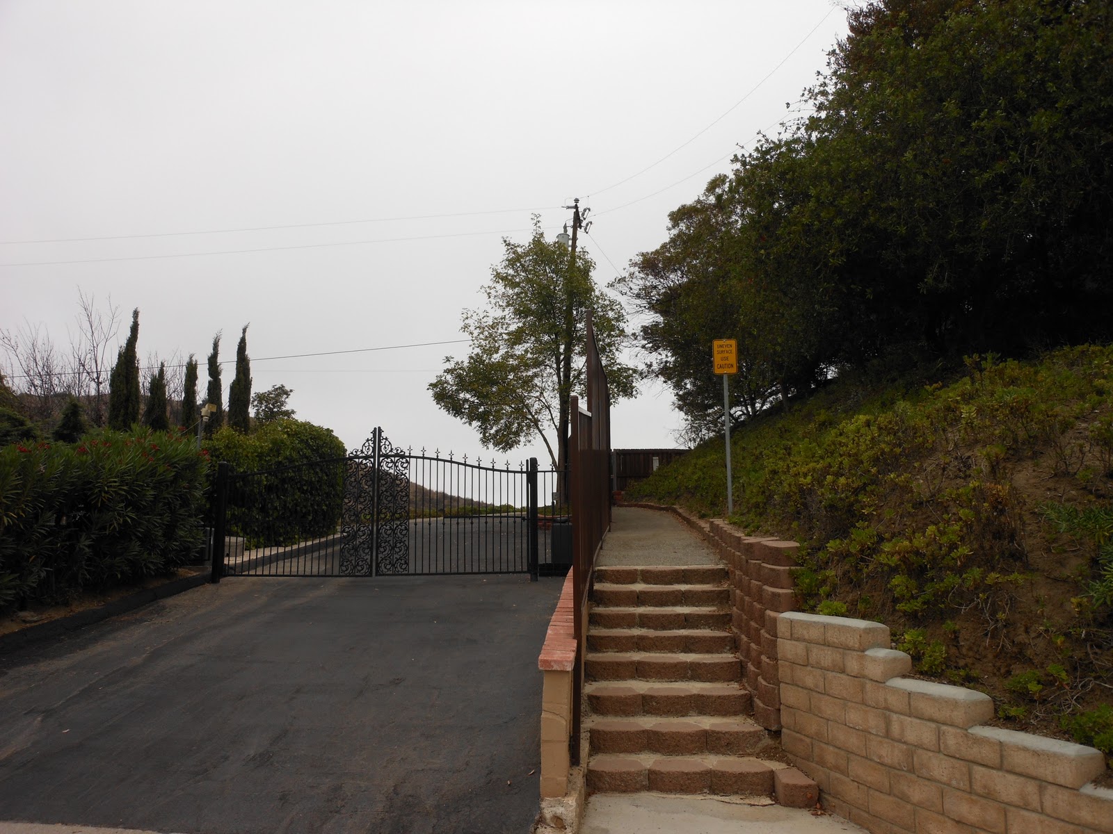
 Legit Trailhead


 Just warming up...

 Looking back at the roller coaster trail

 Alone on the ridge

 Looking back after another gnarly climb!

 Las Virgenes area in the distance

 I wasn't sure where this trail was going to lead me but after awhile it began to make sense.  After a couple of miles I had to stop and turn back but I imagine that if I kept going, the trail would lead out to the corner of Mulholland Hwy and Las Virgenes.  I know there is a trailhead there but I haven't attempted it yet.  I suppose I will have to try that one soon to test my theory.

This was a strenuous climb!  No shade and the scratchy thistles were a bit bothersome at first on the narrow trail but the route became more clear the further I hiked into it.  There were a couple of alternate choices to the right but I kept hiking back and to the left on what I considered the main route.  There are no signs and I am really curious to see where the right trail goes.  Not long ago, I tried making my own trail just a couple miles down the road from here and I ended up torchering myself just to get out of here.  I bet the right path overlooks my mistakes from that day...


Day 319: Thursday September 29, 2011
Liberty Canyon Area
2.5 miles  +50 feet
Across the street from where I was yesterday is another Santa Monica Mountain Recreational Sign.  I figured that I would explore this region today but was met with disappointment.  There is no trail.  I should have figured this because the freeway was just on the otherside.  I poked around in the bruch a bit and then snapped this picture from the street.  I then began to jog along the road up to Cheeseboro and back.  Ok, I walked a bit because I haven't really been in the mood much to run but I am contimplating running another half marathon and 10k soon so I better figure it out!


Day 317: Tuesday September 27, 2011
Lake Lindero
2.5 miles +25 feet

Until now, I'd never been to the Lake Lindero area.  I glanced at Google while I was at work and decided to explore.  Well, not even a park!  Just a residential track hoarding their own lake.  I walked/jogged around with my shirt off to grab some sun.  I looked out over the water thought it would be nice living on a lake.  That said, I prolly wouldnt want someone like me with their shirt off standing on my side lawn. 


Day 315: Sunday September 25, 2011
Arroyo Verde Park
4.75 miles  +550 feet

Soccer/football at the park with the wife, kids and Sammi.  Before the barbeque, I jogged the trails with Sammi and searched for some of my old seal treasures.  Without reading the blogpost clue, I couldnt remember exactly but I did find one on the far hill toward the bridge.  On that day, I hiked back to the right to round back to the main trail.  So, today I hiked to the left.  Sure, I'd been there before too but rather than follow the road up to the radio towers, I cut across and ended up back by the ball fields.  I figured that I footed at least a mile of new terrain on this hill today...


Wednesday, September 28, 2011

Day 316: Ormond Beach Preserve

Hueneme Pier from Ormond Beach

DAY 316: Monday September 26, 2011
Ormond Beach Preserve
Miles: 2.25
Elevation Gain:  25 Feet
Where?: Port Hueneme, CA
Time: 45 minutes
Difficulty (1-10): 1
Reward (1-10): 2
Description: No Beach Access!  Hidden preserve - polluted!
Directions: From the 101 freeway in Oxnard, exit on Oxnard Blvd and head south.  Take this all the way through the city and stay straight as it turns into Saviers.  At the end, turn right on Hueneme Road and then turn left on Perkins.  Take Perkins to the end and turn right in the parking lot.  There are faster ways to get here but no matter what you do, you'll have to drive past some of the slummiest parts of Ventura County.
**MY 316 DAY SUMMARY:   Miles  + Feet**

 Take the bridge across the channel

 Polluted rainbow in the water

 Careful not to step in water

 There is no escape

 I surprised the homeless people living here

 Point Mugu is just beyond the Edison building

 aw, so cute...
This could be a nice area if it wasn't in the poorest part of the county.  I was afraid for my car when I parked it because there were cronies smoking up and hoodlums drinking beer while blaring their music.  As I turned down Perkins from Hueneme, I nearly ran into two bikers that rounded a corner real fast.  Crazy enough, I later saw these two clowns by their tent.  They said I scared them; likewise...
I suppose my mission today was to reach the beach and connect the dots but it's not happening from here.  Unless I was going to swim through it, it's impossible to reach the beach.  I walked as far as I could go to each corner.  There is a larger channel blocking you from the nicer Surfside Condo area.  You are better off parking at the Bubbling Springs, feed some ducks and then walk to the pier from there if you choose to hang out in this area.
Rewind:
DAY 312: Thursday September 22, 2011
Glenwood Park
Miles: 2.25
Elevation Gain:  50 Feet
Where?: Moorpark, CA
Time: 1 Hour
Difficulty (1-10): 3
Reward (1-10): 2
Description: Cut through the fence and run along the ravine
Directions: Off Tierra Rejada In Moorpark
Next to this little park is the Moorpark River.  From the park, I found a cut through in the fence and ran to the left.  I saw some homies walking along the channel drinking a 40 out of a brown paper bag.  It reminded me of Cleveland.  They prolly wondered what kind of guy I was for wearing spandex and running, but I really didn't care.  I made it to a bridge and across the way was a large soccer park.  Surprised Alyssa hasn't played here yet.  I turned around and went back thinking that I will job the other side tomorrow.
DAY 313: Friday September 23, 2011
Arroyo Vista Community Park
Miles: 2
Elevation Gain:  50 Feet
This is the park that I saw yesterday, adjacent to Moorpark Highschool.  I drove to the back by the soccer fields but decided to hop the fence near the entrance and hike along the other side of the river.  I made it to a bridge turned around and came back.  Nothing to glamorous about it but I spent a good sweaty hour to work off most of the food that I ate during the week.


Sunday, September 25, 2011

DAY 314: PACIFIC CREST TRAIL (PCT): Bouquet Reservoir

 My first steps ever on the PCT!
DAY 314: Saturday September 14, 2011
PACIFIC CREST TRAIL (PCT): Bouquet Reservoir

Miles: 2.50
Elevation Gain:  500 Feet
Where?: Palmdale, CA
Time: 45 minutes
Difficulty (1-10): 2
Reward (1-10): ***10
Description: Easy trail for all!  However, this area is known to be insanely hot in the summer months and there is no shade to escape. 
Directions: Where do I begin :)...  From the 5 Freeway, take the 14 North to Palmdale.  Exit on West Palmdale Blvd and head West.  This becomes Elizabeth Lake Road, keep driving west.  ~Roughly 10 miles up, turn left on Bouquet Caynon Road (This is just past Godde Hill Road which you will pass on the right).  Several miles down once you enter the Los Angeles National Forest, the PCT trail crosses the road.  There is no sign visible from the roadway, but shortly after a "corral" on the right, if you look to the right, about a quarter mile up you may notice a small trail sign on the right.  There is a turn out on the left, park there.  If you pass this area and reach Spunky Canyon Road, turn around and drive back exactly 2.0 miles.  *A faster way to reach this trailhead from Ventura is to take Bouquet Canyon Road out of Santa Clarita, pass the Bouquet Reservoir and Spunky Caynon Road... 
**MY 324 DAY SUMMARY:   Miles  + Feet**


PCT Trailhead North of Bouqet Canyon Road

 
Water container for the PCT Warrior

There are a gazillion readings about the PCT trail.  Most novice hikers and all avid hikers are familiar with the 2650 mile foot route from Mexico to Canada.  It's common for people to leave gallons of water for those who hike through it.  Looks like someone has already refillled from this one because the container was empty.

From here, just 464.9 miles to Mexico...

 
Looking back at the first half mile that I hiked...

 
Marble tones on the trail for my kids

 
A silhouette of me

 
Views of Bouquet Reservoir in the distance

About a mile and half into my hike/jog I turned around and ran back down.  The wife and kids were in the car waiting as I introduced myself to the trail; my destiny and passion.  Earlier that day, we drove up to Quartz Hill, near Palmdale, for Alyssa's soccer game.  The undefeated 4-0 Ventura Mighty Vipers were challenging the 3-0 Quartz Hill Club.  This is a team that they lost to in the Palmdale Tourney and it appears they met their match again by losing 4-1.  A rare defeat for Ventura but hopefully it will be a building experience come playoff time.

Bouquet Reservoir from street level (after the hike) 

 
Views of the valley from Godde Hill Road (Quartz Hill)

 
Views of Quartz Hill

Including an additional 1.25 of wandering at J. Walker Middle School in Quartz Hill, my mileage today was 3.75 miles.

Rewind:

DAY 308: Sunday September 18, 2011

Shell Park & Sespe River Overflow
Miles: 2.00
Elevation Gain:  100 Feet
Where?: Fillmore, CA
Just a day after our half marathon run, Jess and I relaxed to Ayden's diving at Kimball Park.  Rather than head home, we took a 20 minute trip down the 126 to Filmore.  At Shell Park off Old Telegraph Road, we explored the Sespe River Overflow.  It is possible to hike this river all the way to the Los Padres where it will take you to the back country.  I've read blogs and articles of the crazies hiking the off route section.  I believe they call the hardest part, "the narrows".  In fact, it would be impassible without having to swim for a portion of the trip and be prepared to climb waterfalls.  --Our legs were not as burnt out as you would think after the hard 13-mile run.  In fact, on the very next day, my son and I hiked the Cozy Dell and my legs felt strong enough to climb another thousand or so feet without issue...


DAY 310: Tuesday September 20, 2011

Miller Park
Miles: 3.50
Elevation Gain:  250 Feet
Where?: Moorpark, CA

Off Miller Parkway in Moorpark is Miller Park.  Cool spot for a full court basket ball game or hang out with the dudes to play stick ball.  For me, walk across the open grass to the open space.  There is a trail leading into a wooded section and then back out toward the 23 freeway.  There was more space back here than I anticipated so I will likely come back to shoot pictures and hike behind the houses.


DAY 311: Wednesday September 21, 2011

Dixie Canyon, Longridge Park & Dodger Stadium
Miles: 3.75
Elevation Gain:  350 Feet
Where?: Sherman Oaks, CA

 Matt Kemp hit a 3-run Home Run!

The new spot today was Longridge Park (not really a park).  I won tickets for a Dodger game, third time this year and Ayden was done to go.  He remembered last time that we went and he knows I hike every day so he wanted to visit Dixie Canyon, the cool spot we hiked last time.  So, with plenty of time to spare, we hiked the first portion of the trail.  The coolest part about it was the street leading up to the trail.

Then, basically one road over is Longridge Ave.  We drove down there in search for another spot to hike.  We turned right on Longridge Terrace and the street ended at a fence with a dirt road behind it.  --Open Space and we hiked for a few moments but we had to cut it short.  The first pitch would be in 45 minutes and depending on traffic, we were about that far away still...

It was nearly a 4 hour game on a school night and the Dodgers lost, again...


Pictures on Day 313: 


***To be continued...

Thursday, September 22, 2011

Completing Days 300 - 309: Cozy Dell Trail


Going to war?


Day 309: Monday September 19, 2011
Cozy Dell Trail
Where: Ojai, CA
Total Distance Today: 3.5 miles  +700 feet


Directions:
From the 101 Freeway in Ventura, take the 33 North to Ojai.  If you know the La Luna shortcut, great, otherwise follow the 33 North past Meiners Oaks.  Only a few miles out of the residential area, you will see the Cozy Dell trail sign on your left.  Park on the left.  The trail is across the street on the right.  If you have kids or dogs, keep them close because the cars will zoom down the roadway.

 Nice shaded trail

 Steady easy uphill for a little over a mile...

 no resting...

 look out for the rock...

 about a dozen easy switchbacks

 I did this less than 48 hours after my half marathon

 ahh, with ease...

 the top, or is it...


From here, we saw the men with guns hiking up on a single track off trail.  The route they took was not marked on the map but it appeared easy to follow, albeit, straight up...  After enjoying the scenery from this vantage point, we continued down on the main trail.  After dropping a hundred feet, it climbed back up again and met up with another side alternate high trail.  My guess is that you can loop the hill to the left.  The warriors were carrying snipers so Ayden and I kept low...

We turned around shortly after, which was disappointing because the trail would have intersected a dirt road in less than a quarter mile.  From the 33, the road is only 1.9 miles, we probably covered 1.75 of that.  However, we had to get back before sun down, it was a school night and I still had to pick up Domino.  I've been leaving her with my buddy Rich who lives in Ojai; one week on, one week off.  I think it's good for her because Rich was a major part of her life and I know his son appreciates it...


***REWIND:

Day 300: Saturday September 10, 2011
Above Calle Arroyo
Where: Ventura, CA
Total Distance Today: 2.5 miles  +200 feet


A few months back, I hiked from my house out of the Arroyo Verde Park and into the open space.  After going up and over and around through some nasty thick, I pleasantly settled down to a switchback of avocado trees.  Of course, this lead to private property but beyond the fence appeared to be another hill with trees and no thistles.  Well, on this day, I was in search for a legit way to trek the open space.  FAILED!  I refused to go down the residential driveway, but I did find a gated community of sorts up here.  The driveway was fenced and concealed but the walkway was open.  So, Sammi and I walked through the gate which lead to a short fire road.  On the other side of the road was the Colina Vista area.  There is no way to drive to this neighborhood from up here.  You only other option is to drive down to foothill, around and back up again.  Unfortunately, the trail portion of my walk today was only about a quarter mile total, but I did stroll the streets up here for some time in search for another public opening.  In fact, I found one!!  Yeah, I discovered this nearly a year ago with Alyssa when we eventually decided on a night hike at the Kimball Park Tunnel.  Bottom line, there is no legit way to hike into the hills unless you are hiking out of Arroyo Verde or you know someone living up here.  Still searching...


Day 301: Sunday September 11, 2011
Ventura Missionary School
Where: Ventura, CA
Total Distance Today: 2.0 miles  +100 feet


***A moment of silence for the 10-Year Anniversary of the 9-11 Tragedy...

On this day, Alyssa had a soccer game and as a tribute to the disaster, I edited the game and published it to YouTube.  If you are interested in watching this game, please check it out:


---Later that day, I decided to keep searching for open space access in Ventura.  The Ventura Missionary School is off foothill just before Kimball.  Pretty much, the fence is locked and separates you from the wild land.  I tried, I found a way to wander a bit and hopped a fence.  However, I cannot recommend it but at least I scratched this location off my list and hiked another day.


Day 303: Tuesday September 13, 2011
Los Robles Trail
Where: Newbury Park, CA
Total Distance Today: 8.0 miles  +600 feet


***NO PICTURES!!!  Today was my last big push before the upcoming half marathon.  I hiked/jogged the section off Morepark Road and then to the west.  I have been back here before but I never raced all the way across to the other side, until now...

Fortunately, I uploaded everything from my camera through Monday the 12th, including the Soccer Video.  This information was stored on my hard drive but after my hike on Friday the 16th, I uploaded again and was going to update this blog.  However, when I tried making the Soccer Video, I accidentally uninstalled my computer's registry, in addition to several other things including pictures...  The mistake cost me over $200 to fix.  This all happened because my new Nikon Camera was not compatible with Microsoft Movie Maker.  SO FRUSTRATING!!!...  Finally, I got the computer back, found a way to convert the videos and here we are now... A week behind updating the blog but still hiking...


Day 304: Wednesday September 14, 2011
Chumash Park
Where: Agoura Hills, CA
Total Distance Today: 2.0 miles  +25 feet


Nothing special about this place.  Just an easy going park.  I took some nice pictures, but they were erased. No big deal.  At this point, I just joggd about a mile and then walked a bit just to keep the legs loose in preparation for the big run on Saturday. 


Day 305: Thursday September 15, 2011
Sumac Park
Where: Agoura Hills, CA
Total Distance Today: 2.0 miles  +25 feet


Much like Chumash Park, Sumac is off Kanan just one block up.  I had seen signs for these parks many times on my recent voyages to the open space further up the road.  Between Chumash Park and Sumac, Chumash is better for kids but Sumac was better for me.  After jogging the oval cement path, I wandered out of the park and discovered that this too lead to open space.  First you have to cross the soccer fields.  I decided to not tempt my curiosity because in just 2 days, I would be running and the last thing I needed to do was wear my legs out with a climb.  --Speaking of soccer fields, Alyssa's game was at a crummy soccer field set up at the elementary school set up across the street.  Why didn't they play here?  These fields were in much better condition...


Day 306: Friday September 16, 2011
Morrison & Forrest Cove Parks
Where: Agoura Hills, CA
Total Distance Today: 1.5 miles  +50 feet


Off of Thousand Oaks Blvd is Morrison Park.  Small, but the grass is green.  There is no open space access here.  I crossed T.O. blvd and found Forrest Cove Park,  Neat and shaded area, nice homes and there is a small section of space back here.  I kept it real easy today, no jogging, just walked.  The half marathon would be the next day.

****More updates later, still trying to catch up....  At least now I have pictures...

Translate

ALEX'S LEMONADE STAND

ALEX'S LEMONADE STAND
Raising Money for Pediatric Cancer

RWANDA WATER HIKE

RWANDA WATER HIKE
Click Image to Learn More