Wednesday, February 29, 2012

Day 468: Sullivan Canyon Trail - Westridge Canyonback Wilderness Park

A dozen of these birds flying around the neighborhood

Day #468 Hike #529 * New Track #477
Saturday February 25, 2012
Sullivan Canyon Trail - Brentwood, California

Westridge Canyonback Wilderness Park
My Tripometer: 2 Hours * 3 Miles * +400 Feet

Skylar is first to the Trailhead

Directions:
From the 405 Freeway, exit on Sunset going towards the beach, turn right on Mandeville Canyon, left on Westridge Road, left on Bayless, and left on Queensferry Road.  The trail begins at the end of the road (there is very limited parking; we took the last available spot on the street.

 Take the paved road down the steep hill and then cross the puddle

 Welcome to the wilderness


 This is an easy mountain bike trail

 About a quarter mile from the car, the swing will be off to the right

 3 minutes further, another rope swing!

This dude was making noise so I looked up.  Where am I? 
(Never seen these birds in the wild before)

 Ayden locked up in a Tree Jail
This is where he belongs :)

 Not much elevation change for the first mile
(Other than the initial drop in)

Crossing the gentle creek

At about a mile or so in I noticed that we began to climb slowly.  The elevation grade was no more than a couple percent.  We were getting close to exiting the canyon, I think, but the trip became too long for the wife and kids.  Just as we started to show signs of a good workout with elevation increase ahead, we turned around :(.  It started out so promising too; with the seings and birds - even the cool houses in the neighborhood.  But, my family doesn't really like hiking!  Sucks for me!  --  This is a cool place!  My first ever visit to the Canyonback Wilderness.  There are plenty of trails in the area to choose from.  I will return and I will try to convince the wife to take a bike road along this one...

Tuesday, February 28, 2012

Day 467: Mt. McCoy - The Cross

The Cross

Day #467 Hike #528 * New Track #476
Friday February 24, 2012
Mt. McCoy Trail - The Cross - Simi Valley, California

My Tripometer: 1 Hour * 2.5 Miles * +600 Feet


Directions:
From the 101 Freeway in Thousand Oaks, take the 23 Freeway North and exit on Olsen.  Turn right and follow Olsen for several miles as it becomes Madera Road.  You will enter the city of Simi Valley and then turn left on Royal (Traffic Light).  Make an immediate right on Alcapulco Ave and then an immediate left on Washburn.  At the curve where Washburn becomes Los Amigos, the trailhead will be on the left.  Park your car and begin...

 The Cross rises above the trail

 Confusing Intersection

From the trailhead you will walk follow a fence for about 40 yards toward the end of some other random street.  From here, the trail begins on the other side of the fence.  Within 25 feet you will reach this intersection.  Naturally, I choose straight.  I actually took the picture on my way back because going straight is wrong, unless you want an intense climbing workout.  Thus, turn left to take the easy, yet longer way up... 

 Going straight up!

Shortly after the intersection you will realize that there is no exact marked trail so I figured to point my direction toward the cross above.  If I recall, I took a right fork, then a left fork and then I begin questioning my ability because the grade was 45%.  Fortunately, the Cross does not sit very high above so the pursuit is definately doable.  That said, children should use the switchbacks by turning left at the very first intersection. 

Less than 20 minutes to the top!

 A Caterpillar with Wings

 Sinaloa Lake from Day 463
(Unlike that day, I can actually see the lake from here!)

 Views in all directions

 Alamos Canyon from Day 444

 Sit back and relax...

The History of the Cross: www.simitrailblazers.com/hikes/mtmccoy
I came across this in my normal daily activities in searching for trails to conquer.  A couple months ago I decided to begin hiking West Simi Valley and I really am starting to master the area.  This website has also given me more suggestions and maps for all of Simi Valley: www.simitrailblazers.com/hikes/index

This was Presidents Day week and I hiked twice right around the Ronald Reagan Presidential Library, which I have never been.  I should have honored this country by hiking there, but this Mt. McCoy hike was worth the visit.  In fact, from the top of Mt. McCoy, you can trek across the ridge and then back down to the library.  Unfortunately, I did not have that kind of time today.  - I shall return!

 Heading Down (the easy way)

You can pick up this trail right next to the first bench closest to the top.  It's actually a silly trail.  I say that because the grade going down is like 1% to 2% at most.  Way too easy.  However, there are many alternate ways to cut through the switchbacks.  I normally would not recommend going off trail like this, but these easy 5% to 10% grades are easy to find and walk on.  There are literally hundreds of possibilities to change up your course.  Like a chess game, there seem to be infinite ways to combination climb this trail.  I decided to keep it real and stay on the main trail the entire time.  Like I said, I felt silly because I would walk a couple hundred feet, switchback and then walk back and only be lower by 10 feet.  Meanwhile, I could have just taken a quick cut to cheat the steps.  It's really your choice, but all trails lead to the same spot...

 Sending a Peace Out to the Cross

 The silly switchbacks


Cactus Field near the end

**Rewind:

Day #466 Hike #527 * New Track #475
Thursday February 23, 2012
Just Beyond Pleasant Valley Fields - Camarillo, California

My Tripometer: 3 Hours * 2 Miles * +25 Feet

 Ayden vs. Alyssa

 Last chance to hike this field...

Trail across the field

Today was set to be a duplicate hike while Alyssa had soccer practice but I find a way to make it somewhat interesting.  Really, no big deal.  Ayden and I took the half mile trek across new soil and then rounded the mile track at Pleasant Valley Fields.  We danced around to extend this into a two mile journey and then rejoined Alyssa at soccer practice.  I was a shagger.

Sunday, February 26, 2012

Day 465: North Grasslands Trail / Las Virgenes Trail to De Anza Park

Pepsi; Will you Sponsor me???

Day #465 Hike #526 * New Track #474
Wednesday February 22, 2012
North Grasslands Trail to De Anza Park - Calabasas, California

Las Virgenses Trail / Unsecured Trail
My Tripometer: 1.75 Hours * 4.75 Miles * +450 Feet


Directions:
From the 101 Freeway in Calabasas, exit on Las Virgenes Road and head south towards the ocean.  Stay on Muholland for a few miles and then turn right on Muholland Highway.  Today's trailhead will be just a couple hundred feet down on the right.  Park on the street and hike past this sign.

Sepulveda Adobe (immediately on the left)

I actually intended to hike from De Anza Park today, but I didn't realize that I had to turn down Lost Hills Road to reach the park.  This was probably for the best because of the circumstances of this hike.  I discovered the park just a couple weeks ago Day 452: Liberty Canyon Trail - Talopop Trail to De Anza Park


 Wrong Way!

After you pass the Sepulveda Adobe, you will follow the trail into an open field, hence Grasslands Trail, and then intersect a paved road.  There is a small power station on the right so I chose to turn left.  I followed the road about a quarter mile and reached a gate.  On the other side of the gate is this road.  It looks like I could have crossed and continued but I had my mind set on De Anza Park.  Thus, I turned around to rejoin the trail.


 I prefer Pepsi!

So my plan is to ask Pepsi to sponsor me.  My goal is to drink one Pepsi a day AFTER the hike.  Of course, to help sell the idea I figured that I should drink one along the hike.  I decided that my long term goal is to hike Mount Whitney on Day #1000.  On top of the Mountain I will drink a can of Pepsi.  Of course, if Coke or some other soda or drink offers me a contract, I will have to go with them.  I am open to sponsorship.  I am not monetizing this blog nor am I profiting from any of this.  The experience is amazing but becoming costly with gas and whatnot.  It only makes sense at some point to do something, but one thing will not change; This Blog Will Always be FREE!!!  I enjoy sharing the trail information!

 Back to the junction, no signs but from the trail turn right...

 Around the bend, another no signage fork: TURN RIGHT!

 Follow the Trail

 Ah, a sign!  Turn RIGHT, do not go into the field...

Keep going...


 Cross the bridge

I came from the left side of this picture...

If you make a 180, you will reach the trail that I hiked just two weeks ago.  Thus, I hiked all but a quarter mile of the Liberty Canyon Fire Road.  I did hike the Day 459 Phantom Trail last week.  I am mastering this area quickly!  So, as the sign indicates, proceed forward to the Las Virgenes Fire Road.


 The trail goes up and to the left

 Take the V-Turn down the Las Virgenes Trail

FYI- If you did want to hike from De Anza Park to Liberty Canyon Road or vice versa, taking this route around versus the hilly Taleopop Trail would be much easier and faster.  The fireroad trails have little elevation gain, which is great for jogging; especially when you have PEPSI POWER!

 A Tree

 The third time I've seen this Coyote in consecutive weeks!

 My what big teeth you have!

 Through the grasslands

 Easy Elevation Gain

???

 Pass the Taleopop Trail Junction - The bridge to DeAnza Park

 To the left (rear) of the park, let's check it out...
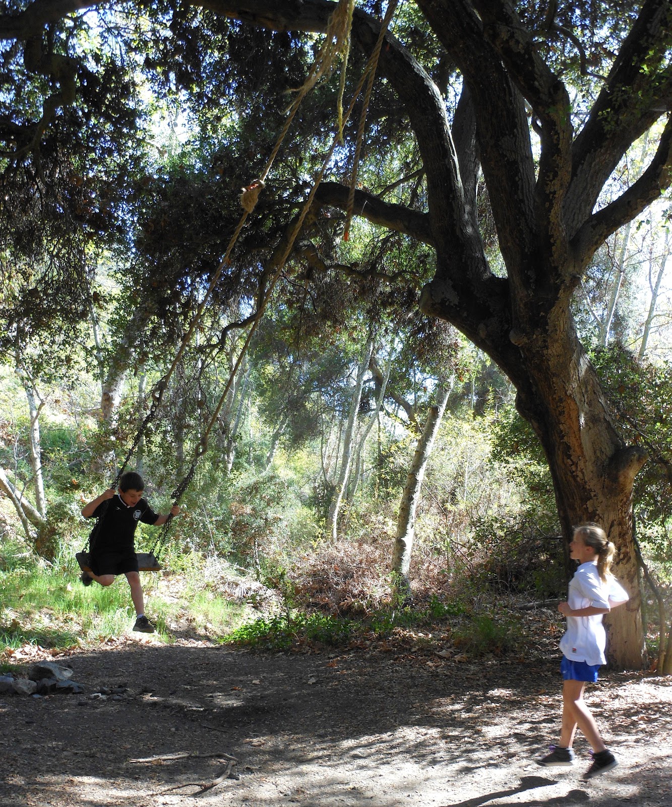
 The Swing Tree

 De Anza Park from above


High above the Tree Swing (looking back toward Liberty Canyon)

The unmarked trails spur off in several different directions.  I found one that looped back toward my route home.  The sun was setting so no delay, I am on my way...

 Heading Back

 Pretty?!

 A young Buck with his Doe

 There was also two little fawns nearby...

Sunset over the M.A.S.H. backdrop

I know that the M.A.S.H. site is somewhere back here.  SkyHiker shared with me his experience.  He commented the link on this blogpost: Day 399 Rock Pools at Malibu Creek Park
--I will retrace his footsteps in the near future...

Translate

ALEX'S LEMONADE STAND

ALEX'S LEMONADE STAND
Raising Money for Pediatric Cancer

RWANDA WATER HIKE

RWANDA WATER HIKE
Click Image to Learn More