Mt. Elbert - 14439 Feet - Highest Peak in Colorado
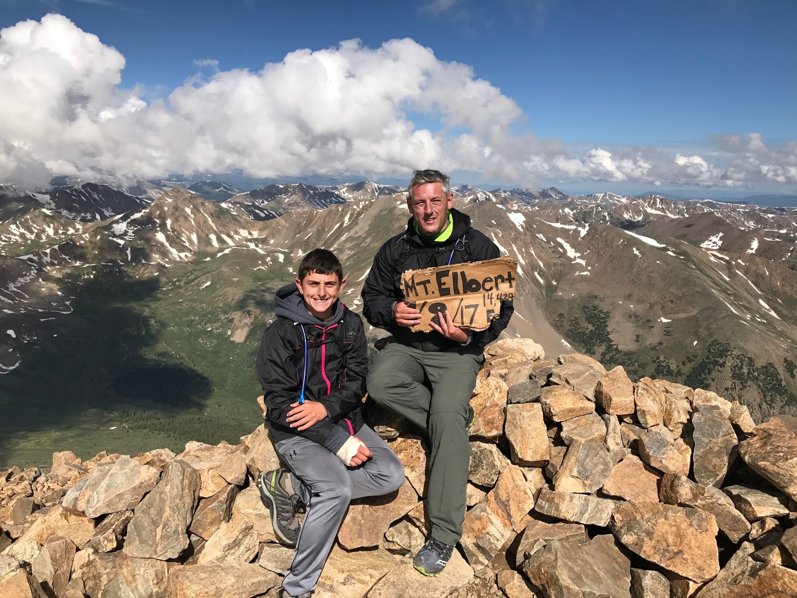
On July 13, 2017, Ayden and I climbed the highest peak in Colorado, Mount Elbert. At 14,439 feet, Mt. Elbert is the 2nd highest peak in the contiguous United States. Only Mount Whitney, the highest peak in California, stands taller. That of course I accomplished: Day 1000 - Mt. Whitney. Still, what used to be called Mount McKinley, now known as Denali, standing at over 20k feet, Alaska holds the champ for our great nation. As I aspire to summit all 50 states, I may leave this one on the table for my son, or perhaps my future grandson or granddaughter. My hiking legacy will be complete with that feat!
We read about it and then learned quickly that Colorado, in the Summer Months, gives way to electric storms in the early afternoon. It was so true! Every day in this state was the same; a beautiful morning followed up my lightning strikes and rain by afternoon into the evening. There was a pleasant harmony about it, but I would not want to be caught singing a duet with Elbert...
An hour or so later, we climbed past the thick forest
Cool morning temperatures made the wooded uphill tolerable
Sun rises above the range beyond
We clear the treeline
And look, we are Carebears!
Mount Massive across the way
I believe Massive is Colorado's 2nd highest peak (could be wrong - but its high like that!) I believe the route itself to the top is longer and more challenging. The trailhead is only a quarter mile or so from the Elbert Trailhead, but look how far we already are!
There are three different ways you can climb Mt. Elbert. We took the easiest and most popular route of the three...
Just Awesome!
It doesn't look that hard, but it sure was for me!
You understand, it goes down over 1000 feet below those clouds!
Refreshing!
It's Crazy that we were even doing this! Ayden broke his arm just 10 days prior. He's a true warrior, when he wants to be, and despite the arm and Asthma, little man conquered this rock! It was me who was dragging ass!
Yes, it just keeps getting steeper
On top of the world!!!
Tallest human with his feet on the ground in Colorado, for that moment!
The first/last tree
Heading back down, this tree's roots are buried in soil higher than any other, along the trail anyhow. It's interesting watching the trees grow taller as you decent. Poor little guys up top barely muster the strength to stand, but they do and they are precious!
These are the parts we did not see going up, as it was dark then. Glad we hit the summit before noon as it went from cold, to reasonable to wind up top and cold again quick. Perfect weather though, I was passed by many hikers. However, many other late departures turned around early. Others beyond that did not have the vigor to accomplish the task. Somehow, I find my way. Ayden, it's like 2nd nature, so easy for him. For me, I just need to, no matter what!
Our Campsite
There is a 5-mile long dirt road leading up to the Mt. Elbert and Massive Trailheads. As you see, I have a 30-foot Class A Motorhome, and I made it with no issues. The road for the most part is flat. You are not zigzagging up a mountain road. However, it is grated, which means it runs rough to protect the road from the rains. Thus, travel slowly my friends. Perhaps a better, alternative route would be to park at Twin Peaks Campground and hike from the south along the Black Cloud Trail. I'll write about this separately. As far as coming from the North, like we did and as described in this blogpost, there are many pull in camp sites along the dirt road. There is a campground at the end of it as well and the trailhead has available parking, although not for overnight. Perhaps I got lucky, finding a spot for my RV less than a quarter mile from the trailhead. I pulled in here the night before just before the rains came and got out just before they came back. Mt. Elbert - A Perfect Hike, and another highest peak accomplished!


No comments:
Post a Comment