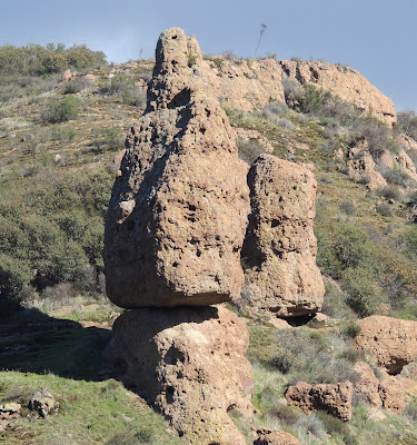
Split Rock
Day #803 * Hike #1005 * New Track #788
Sunday January 27, 2013
Mishe Mokwa Trail - Malibu, California
Split Rock - Skull Rock - Balanced Rock
Carlisle Canyon - Echo Cliffs
My Tripometer: 2.5 Hours * 4 Miles * +500 Feet
Trailhead
Directions:
The parking area is just about a mile down the Road from the Sandstone Peak Trailhead. From the PCH, turn up Yerba Buena Road which is the road that goes up the hill from Neptunes Net. Today's trailhead is 7.0 miles from the PCH just before Triunfo Pass.
Check out the two other Amazing Hikes that I've done off Yerba Buena Road:
- Day 546: Sandstone Peak - Highest Point of the Santa Monica Mountains
- Day 118: The Grotto Trail - At Circle X Ranch
The first 0.4 miles is along the backbone trail. You will be gradually gaining 200 feet of elevation. No switchbacks but the trail is a bit steep in some places. It was especially muddy after all of the rains that we have had...
Looking back at the parking area
Ziggy, pace yourself...
Just 0.2 miles separates you from the Sandstone Peak Trail
Stay Straight on the Mishe Mokwa Trail...
Overlooking Carlisle Canyon
Echo Cliffs, and yes they echo!
<~Hello, hello, hello, hello. hello....
a random grassy area
Rock climber's or as Ayden calls it; Climb Rockers!
creek crossing
Up to this point, the majority of the hike was in shade which makes this an ideal hike in the hot summer months. However, it was quite cold so we absorbed the sun in the spots that it shined. Don't let the topo map fool you. You think that you will be climbing just 200 feet in the first half mile and then the trail is level the rest of the way. Nope! Many up and downs to roller coaster the elevation gain. Nothing too extreme and no switchbacks, but try telling this to the 3 year-pd who I had to carry on my shoulders the majority of the way back...
Interesting rock on top of that cliff...
Did aliens put that there?
A close up...
Trailhead for B/R???
Our destination today was Split Rock. It felt like we hiked 2 miles already but between dogs and kids I honestly lost my timing. We hiked down the B.R. trail for a moment and it lead out to an open field. The trail continued to go lower but I knew this couldn't be right. Here is another picture of:
Balanced Rock
Of course I was wandering without my map which clearly states, "Balanced Rock". It took Ayden to figure out at the time that B.R. stood for Balanced Rock. Good job figuring that one out buddy. Proud of you man...
Yet another angle...
Skull Rock
Way cool area, huh!
Finally, cross into the Split Rock Camp!
Cross the refreshing creek
King of the Split
Base Camp
We enjoyed PB&J sandwiches with crackers and lemonade. A perfect Sunday afternoon adventure...
Even Sammi ran through it...
A long hike back...
After our adventure we headed back up the PCH and exited at Hueneme Road. From there, less than 5 miles to Chill Out Frozen Yogurt! We deserved this treat and I ordered a Panini to go :)


Nice pictures. Funny thing is, I hiked the area around Sandstone Peak a few years ago. And some of my pictures seem like they were taken just about where you took yours.
ReplyDeleteI see that quite often on blogs. I guess a lot of folks find the same things interesting enough to take a picture!
golden goose sneakers
ReplyDeletegolden goose
adidas ultra boost
supreme clothing
nike air vapormax
chrome hearts store
timberland outlet
kobe sneakers
yeezy shoes
golden goose slide
fjk7820ls4
ReplyDeletegolden goose outlet
golden goose outlet
golden goose outlet
golden goose outlet
golden goose outlet
golden goose outlet
supreme outlet
golden goose outlet
golden goose outlet
golden goose outlet