Random Rob? on top of Sandstone Peak!
Day #546 * Hike #626 * New Track #541
Monday May 14, 2012
Sandstone Peak - Malibu, CA
Sandstone Peak - Malibu, CA
Highest Point in the Santa Monica Mountains!
My Tripometer: 1.25 Hours * 3 Miles * +1150 Feet
Ready to Climb the highest peak in the Santa Monica Range?
...The task is actually quite simple.
The Trailhead
Mapping the adventure
Directions:From the 101 Freeway in Thousand Oaks, CA, exit on Westlake Blvd (The 23 South). Continue on Westlake for a couple of miles and then continue going straight up the windy road into the mountains. After many dizzy miles you will join Mulholland Highway. Stay on Mulholland Highway and at the next stop sign where Decker Canyon and the 23 go straight, you will turn right on Mulholland Highway. About a halfmile down, turn right on Little Sycamore. This road will take you higher and it sucks on a bike! The road is rigid and narrow. After 4.6 careful miles, the Sandstone Peak Trailhead will be on the right. About a mile before our trailhead will be another parking area - pass that. If you pass ours, you will reach the Circle X ranch on the left which is identified by a flag; thus turn back around.
An easier way to reach the trail is taking PCH and turning up Yerba Buena Road by Neptunes Net. (Little Sycamore becomes Yerba Buena Road at some point). The gravel parking area for the trailhead is up a little gravel dirt road. Impossible for my bike so I carefully placed it near the side of the road in the gravel...
Across the street from the trailhead is the Canyon View Trail. This leads to Circle X Ranch and the Grotto. I hiked the Grotto nearly an exact year ago Day 118 The Grotto
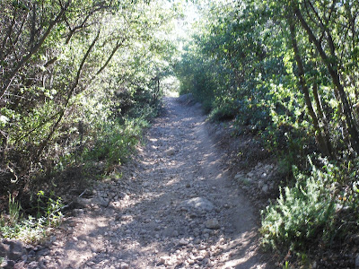
Not far from the start, stay straight on the main trail
Looking down on Yerba Buena Road
First junction, switchback to the left to go higher!
Looking back
Moving Forward
Two lakes were visible as you got higher: Westlake Lake?
The ridge across the way
Finally out of the sun!
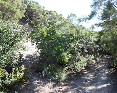
No signs, but the peak is to the left just before the downhill
Very manageable
Almost there...
Final few steps...
The top of the world
Breathtaking...
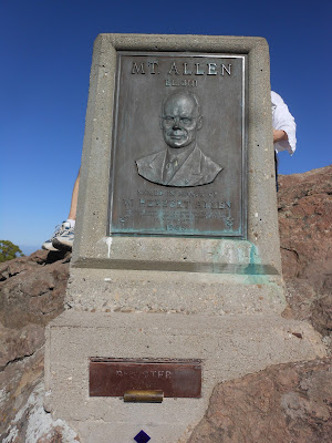
Mt. Allen - Don't forget to sign in
I rushed up in 30 minutes!
Unlike Rob in the post pic, I wouldn't quite go to the edge!
This hike is doable for almost anyone. It really is that easy! I would be cautious at the top with little kids but the trail is in great conditions. There were two log books to sign in and they were both completely filled. The latest entry that I could find was April of 2012. Thus, this please is very popular and someone must come up and archive the log books frequently.
I wish I had more time up here today but I was in a rush to get back to Ventura by 6:00. I was a bit late but I ran down from the top in just under 20 minutes! No wonder my legs were hurting the next day :)
By the way, the top picture of Rob, or maybe it was Bob, from Thousand Oaks, thank you for taking my picture. I know I look fugly but I appreciate you ---
Quick Rewind:
Day #545 * Hike #625 * New Track #540
Sunday May 13, 2012
Kimball Park - Ventura, CA
Kimball Park - Ventura, CA
2.5 mile jog/walk
My Tripometer: 45 Minutes * 2.75 Miles * +50 Feet
I really wasn't in the mood for this today. My wife wanted to jog at Kimball and other than hiking, I have been quite lazy. I don't mind running on dirt, on a trail but I've come to fully dislike running or even walking on pavement, especially if it's in circles. So, today I went around the 1.25 quarter mile once and because my wife, Sammi and Ayden on his bike left me behind in the dark, I took Ziggy through a zig-zag through the thick! If there was a way to complete a new hike at Kimball, I just did it! I went through the forbidden zone which due to the spring growth, this was quite an adventure. Especially for the little dog that mushed through the four foot tall growth!


No comments:
Post a Comment