

Profile Cliff at Taft Point (Elevation 7503 Feet)
Day #576 * Hike #660 * New Track #563
Wednesday June 13, 2012
Taft Point - Yosemite National Park
Fissures - Sentinel Dome - El Capitan
My Tripometer: 1.25 hours * 2.25 Miles * +450 Feet
Directions:
In the southern portion of Yosemite National Park, take Glacier Point Road to the top. Before descending down to Glacier Point, the Taft Point and Sentinel Dome Trailhead will be on your left. We started early which meant there was ample parking. However, when we were finished, the parking was full and people were forced to park way down the street. It makes sense to hike Taft Point and go to Glacier Point in the same trip. Thus, hike Taft Point first to beat the rush...

A coin flip, we chose Taft Point

Quartz formation near the trailhead

A closer look

Two gentle crossings over the sentinel creek

A large rock in the woods

Trail sign at the Phono Trail Junction

Green moss growing on the trees

Fissures, watch your step...

Taft Point 3500 feet above Yosemite Valley

El Capitan far across the valley
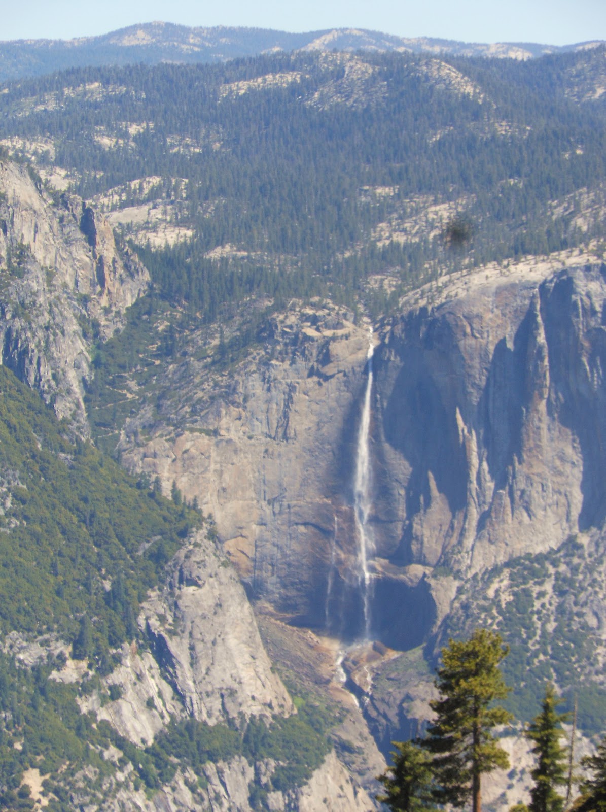
Yosemite Falls to the North East

A wider view

Look out below!

Crossing more fissures on our way back

Hmm, not interested; way too long and not enough time!

beautiful blue markings

Back to the Pohono Trail Junction
We chose to take the easy route back to the car. Besides, looping to Sentinel Dome would have been longer from this direction anyway. Rather than hike to the Dome, Ayden and I jumped back in the car to head out to Glacier Point. From what I've read, Sentinel Dome offers some of the best views of Yosemite. I will have to return to the Park to confirm this.
Listed below are some additional links to help persuade you to visit Taft Point!
kevingong.com/TaftPoint


You make me want to return to Yosemite, but I doubt if the damaged knees will ever be strong enough for more than the valley. We stick close to home in western Oregon, which we also love. A turtle in hand can stride along, air canoeing, but we have to be careful of temperature. http://chelonianconnection.blogspot.com
ReplyDeleteI was recently in Oregon. I drove and hiked down that scenic route outside Portland towards Mt. Hood. Search my blog for the pics. I hope to eventually organize this better but for now, I'm off hiking. Also, check back in a few days when I complete updating my Yosemite Trip.
ReplyDeleteThanks,
JJ
kyrie 3 shoes
ReplyDeletehermes
longchamp
coach outlet
yeezys
christian louboutin outlet
nba jerseys
kd 11
off white nike
yeezy boost
balenciaga sneakers
ReplyDeleteyeezys
hermes birkin bag
adidas yeezy
golden goose mid star
adidas yeezy boost
golden goose
air max 97
golden goose sneakers
nike lebron 15
i thought about this replica ysl check out here replica bags china great site luxury replica bags
ReplyDelete