Thursday, February 28, 2013

Day 830: Hueneme Wharf Plaza - Lighthouse - Port Hueneme

Lighthouse Beach

Day #830 * Hike #1034 * New Track #813
Saturday  February 23, 2013 ***Happy Birthday Hilary! (My Sister)
Hueneme Wharf Plaza - Lighthouse - Port Hueneme, CA

My Tripometer: 45 Minutes * 1.5 Miles * +0 Feet

 Trailhead

Directions:
Free 2 Hour Parking on Market Street!  This is huge because if you park on Surfside or in the beach parking lots, you'll have to pay to park.  Of course, you can always park for free at Chill Out Frozen Yogurt and then just walk a quarter mile to the beach...

 Here is your hike...

 Anacapa

 Difficult Windy Conditions...

 The Lighthouse

 Looking into the Port Hueneme Naval Base

 Silverstrand around the jetty...

Looking back at Hueneme Pier & Boney Mountain

This was hardly a difficult hike.  My goal was to tackle some serious trails every weekend but the time did not allow me to reach the real forest today.  I decided to venture down this way because Chill Out Frozen Yogurt receives many Panini sales from the Long Shoremen.  So, I drove by the docks and then found this pavement.  I decided to take a stroll, hence the hike...


Forward:

Day #831 * Hike #1035 * New Track #814
Old Baldwin Road - Ojai
Sunday February 24, 2013
My Tripometer: 45 Minutes * 1.75 Miles * +25 Feet

On Sunday I took some time out in the morning to venture near the National Forest.  I revisted:  
Day 615: Ventura River Preserve

**If you can tell from my hike on Saturday, I went hiking with my old spotty camera.  So today I just went cameraless.  Personal problems I suppose, I was having some camera issues but have since remedied theses issues.

Anyhow, today I zipped back and forth on the side trails that I did not hit with Ayden last time around.  Oh yes, I recalled my searching for the Geocaches out here but I did not come across them.  I didn't spend too much time searching, but I would lie if I said my eyese weren't stretched open hoping to catch a glimpse.

***Well, back to the Chill Out Frozen Yogurt Shop.  I worked the rest of the day, into the evening and finally came home after 11:00pm.  Back up at 6am for my real job, no not hiking, debt collection...

Wednesday, February 27, 2013

Day 829: Waterfall Trail - Rancho Sierra Vista / Satwiwa - Chumash Village

From the top of the Waterfall

Day #829 * Hike #1033 * New Track #812
Friday February 22, 2013
Waterfall Trail -  Newbury Park, CA

Rancho Sierra Vista  / Satwiwa - Chumash Village
My Tripometer: 1. Hour * 3 Miles * +775 Feet

 Trailhead

Directions
Follow the driving instructions from Day 192: Boney Mountain.  I've begun many hikes from this spot but my climb to Tri Peaks on Day 192 is my favorite.  To reach the waterfalls, I would have to duplicate over my same footsteps for the majority of this hike...


From the parking area, head a quarter mile down the trail and it will lead you out into the open.  Cross this bridge and then hike down the diagonal dirt single track as those people are doing in the picture above.  If you turn left first, you can visit the Chumash Village - been there, done that :).


You will slowly climb above the trail junctions and then begin to make your decent down into the gorge below.  If you click on the Map (taken from Day 192) the elevation points are a bit deceiving.  Just know, if you are not in good shape, these hills are not exactly easy.  Other than that, this hike was a breeze of cake for me; and yes that is one of my coined expressions!

 From here, just another 0.6 miles to the Waterfall Trail...

 Entering the shaded wilderness

 Down into the creek

 Waterfall Trail - New Track!!!

I can't believe that I have never actually been down this before.  Even before these 1000 Days began, I always opted to bypass the falls and climb big to the monument or the top of Boney!  Today was intended to be quick and easy and just a couple minutes further...

 almost there...

 A beautiful Waterfall for Sky Hiker!


There are many stages and pools on these falls.  Climbing to the top is not easy but I gave it my best effort.  One hiker walking back passed me and said, "don't slip".  He was walking barefoot and was soaking wet.

 Not Quite the top...

From the bottom, you will see a root on the edge of the dirt but I realized quickly that this would not be the easiest way.  Since the falls were calm, I pressed my way up through the center and scrambled my way up.  Mostly, yes, this is dangerous and I would not have done it with my kids or dogs...

 Reaching the camera toward the top...

I heard the final waterfall up there and wanted to reach this pool.  However, there was no good leverage point and I was not going to chance it.  I did pretty well and since I was limited on time, I turned back.

 One of the upper pools

One of the lower pools

From here I revved up and ran back to my bike.  Oh, the climb back up along the trail is a drag, you must account for it when factoring in your elevation gain.  It's especially hard to jog it, so that's why I did not jog the entire 1.5 miles back. Overall, real neat place and did all this in just under an hour...

Days 825 - 828: Arroyo Verde

Sunset from above Arroyo Verde


Day #825 - 828 * Hike #1029 - 1032 * New Track #811
Monday - Thursday  February 18 - 21, 2013
Arroyo Verde - Ventura, CA

My Avg. Daily Tripometer: 1.25 Hours * 2.25 Miles * +425 Feet


Monday, Tuesday and Thursdays were all retracing footsteps in Arroyo Verde.  I normally don't take pictures here but since the whole family and dogs were on the trail, I said why not.  We normally do not all travel as a pack.  Unfortunately, I was using my old camera and the pictures did not turn out so well.

On Wednesday I stumbled alone on some new footsteps in the park.  Let's put it this way, next time I'll bring my machete.  Sammi often goes off track and this time, without the kids, I chose to follow her.  We pushed our way through some weeds in the far back by the horse shoe area but was unsuccessful in trying to merge with another trail.  The hills are steep and the overgrown chaparral is unforgiving...

Day 824: King Gillette Ranch - The Biggest Loser

The Biggest Loser!

Day #824 * Hike #1028 * New Track #810
Sunday February 17, 2013 ***Happy Anniversary Jess!!!
King Gillette Ranch - Calabasas, CA

The Biggest Loser
My Tripometer: 1.5 Hours * 1.5 Miles * +25 Feet


Directions:
From the 101 Freeway in Calabasas, exit on Las Virgines and head south toward the ocean.  A few miles up, turn left on Mulholland.  Then turn right into the very first driveway.  You can park in the visitor center parking area for free, up to 2 hours.  On the other side of the bridge is additional parking for the park, but you have to pay there.


We hiked back to The Biggest Loser Headquarters.  My legs were a bit sore from the large hike yesterday but the mild walking felt good.  This was actually a nice relief after cramping up on the long motorcycle ride from Ventura.


We viewed some of the workout areas including what you see in the picture above and the pool.  We did not explore beyond the fields but I imagine there are trails back there.  Today was my 5th wedding anniversary with Jess.  We have been together for 11 years now!  We chilled out and had a picnic.


After awhile, we called it quits here and then took the scenic route back to Ventura.  We rode down Mulholland and of course passed by the Rock Store and I found our pics on the website.  Take a look...

 
After riding around for nearly 200 total miles today, we finally took a load off and settled up at Bombays in Ventura.  There we watched the Shoemaker Brothers, I think that's their name.  Normally, we love watching this local band.  They are quite unique with their violins and music range.  However, today they seemed exhausted and we were not as excited.  I still think that they have star power in them and they should try out for America's Got Talent.  Unfortunately, another couple years of Ventura local clubs and they will be deemed all washed up.  That said, they still command a pretty decent local following.  Mostly middle age women, so I guess I fit right into that :)
 
We concluded the evening with a nice movie and then we met back up with Jerri, our wonderful friend, Aunt if you will, and closed up the Chill Out Frozen Yogurt Shop.  If it wasn't for her, these hikes would hardly be possible and our anniversary would have been making Panini's

Saturday, February 23, 2013

Day 823: Topatopa - Sisar Canyon Trail - White Ledge Camp - Topa Topa Bluff - Howell Place

A Topa Topa Sunset!
 
Day #823 * Hike #1027 * New Track #809
Saturday  February 16, 2013
Topatopa - Sisar Canyon Trail - Upper Ojai, CA

White Ledge Camp - Topatopa Bluff - Howell Place
My Tripometer: 8.5 Hours * 16.5 Miles * +4800 Feet
 
The Map!
 
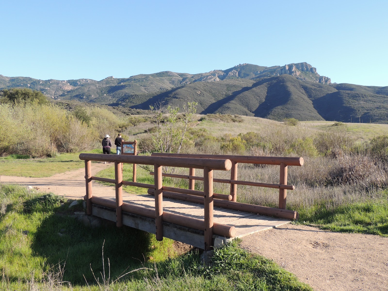
 View of Topa Topa from the 150 Elevation 1500 Feet

Directions:
From Ventura, take the 126 East to Santa Paula.  Exit on 10th Street, the 150 and take this through Santa Paula toward Ojai.  You will pass Steckle Park - Day 294, Thomas Aquinas College where you will smell Sulphur and is the trailhead for Day 648: Santa Paula Punch Bowls.  Keep heading up the 150 until you reach the summit.  The Summit Restaurant will be on your right and then the very narrow Sisar Road will be on your right next to Summit School.  According to the map, you are suppose to park here but everyone drives up Sisar Road.  Pass over the speed bumps, slowly, and continue up the gravel road which turns into dirt.  You can park by the water tank or if you have enough clearance on your vehicle, keep going up the dirt road.  Warning, this dirt road is very rocky and bumpy but it's only a quarter mile or so to reach the trailhead.  Today, the parking area was full but we snuck into one spot to settle in at 10:00am (late for a hike like this).

 Trailhead ~1800 Feet Elevation

**I've hiked along Sisar many times in the past but this is my first visit in my 1000 Days.  I believe today's hike is my longest and largest elevation gain in these 1000 Days.  I am now in training for Mt. Whitney and I plan to do something similar to this every weekend until August.

There are some cool watering holes back by the water tank.  Sisar Road follows a creek and if you look off to the right there are several places to explore.  It often gets very hot here in the summer months and the cool water is a nice way to relax...

 On with the hike, start down the shaded dirt road

 You will pass two easy creek crossings

 Howell Place to the right, stay left up the road


 Ayden's like, "Dad, we are not climbing all the way to the top"

 Heading out of the shade - fortunately its a cool day

 Topa Topa Bluff

 2.1 Miles in,  Follow Troy - take the single track trail beyond this gate

**We eventually meet Troy at the top.  He organizes a yearly camp out and today we met him with 20 friends at the top.  **Warning, before reaching the single track trail we heard a mountain lion off the wide dirt road.  We saw him zig zag his way through the thick up and away.  Good thing we didn't follow the switchback road higher beyond the single track because it would have walked us right into him!

 Nice shaded trail

 Manzanita

We heard and possibly saw another Mountain Lion!  He darted from above the trail, across the trail and down into the creak.  It was like a flash and he was very dark in color.  Very creepy being alone in here...
 Out of the shade and higher again...

 Squirrel

 Entering White Ledge Camp

 There are three spots to camp in here

**My last camp out before starting this 1000 Day adventure was to White Ledge.  I went with Alyssa, Ayden and Sammi.  When we got back home that next day, Sammi was covered in ticks, and Ayden and I found some on us as well!

 Lunch!

It took us 1.75 hours to hike 3.1 miles and +2500 feet to reach this camp.  In fear of the mountain lion, we nearly bypassed this spot but decided that we were hungry.

 Chicken Bratwurst

After a 30 minute stay, we continued up the trail.  It was 12:15 and we were on our way to summit the Topa Topa Bluff...


 View of Anacapa Island

 Looking back on what we've done so far...

 It's a long hike up to the top...

 7 miles from the 150, so we hiked about 6 so far

 Turn right at Nordoff Ridge Road...

To the left, you can hike to Chief Peak and eventually this take you to Nordoff Peak - Day 98.  Just 0.5 miles to the left you would reach the Lion Canyon Trail.  I hiked along this trail on Day 781: West Fork Camp.  About 8 years ago, I also hiked from Middle Lion all the way to the top and then camped out here:

 This site is just off to the right as soon as you start trekking toward Topa Topa

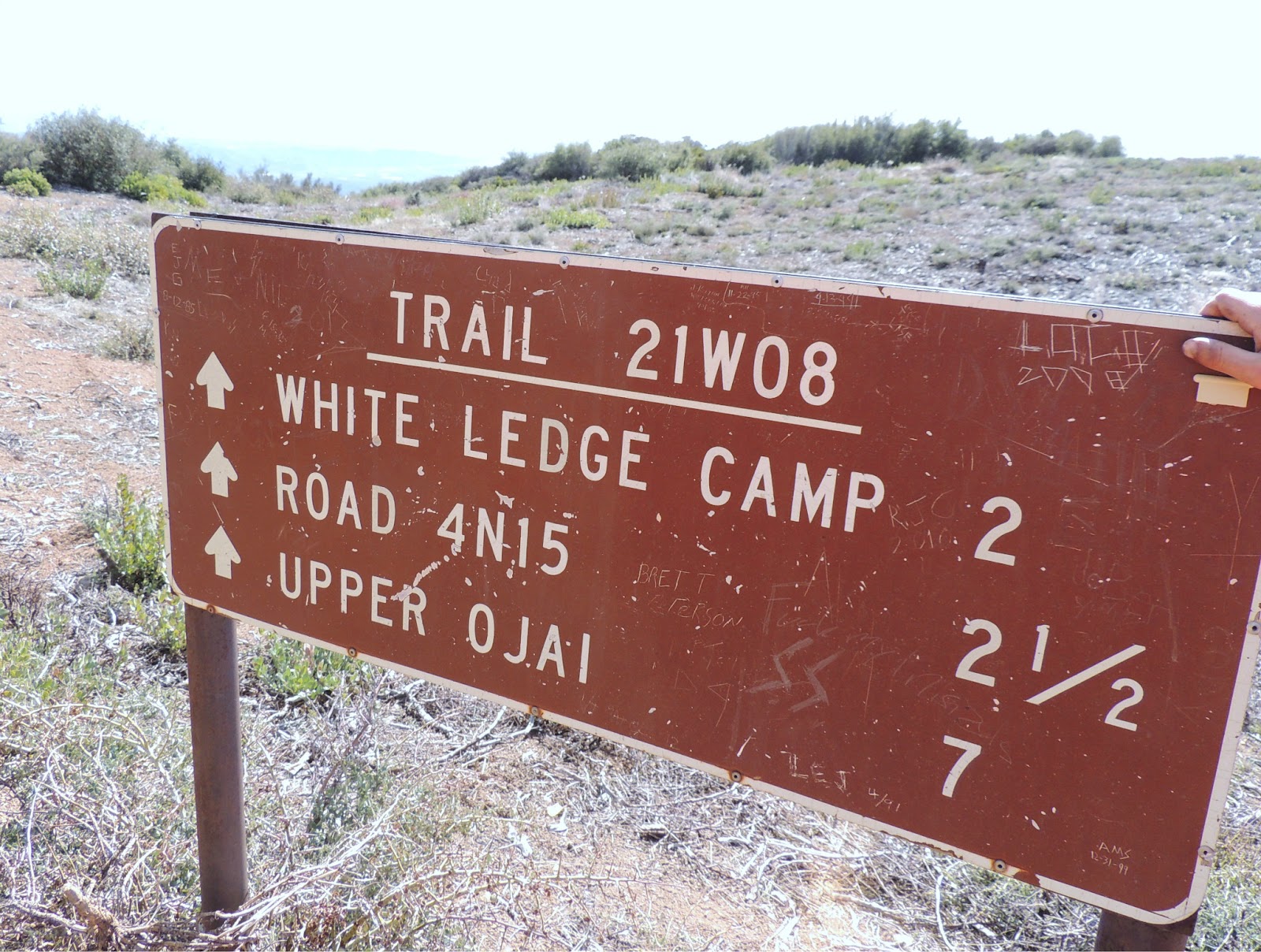
 We saw a trail sign off the right, about a mile further down the road

 Last Chance Trail?

This confused me because according to the map, the Last Chance Trail is another mile and a half up the dirt road, which becomes the Red Reef Trail.  On my hike 8 years ago I hiked down this trail, past Lady Bug Camp and eventually camped out on a second night at Day 223: Willet Hot Springs.  I hiked this with Domino and it was an over 30 mile, 3 day loop adventure.  Domi could barely walk by the end of the journey.  I was in bad shape as well lugging up 80 pounds on my back.  Back then, I looked for the Last Chance Trail but could never find it.  I assume it must have been rerouted and here it is.  In theory, you should be able to hike this all the way back down to the Santa Paula Punch Bowls.  However, from other experiences coming up from Santa Paula, the trail is lost and you are forced through poison oak to reach the Jackson Falls.  I have not been back to that area in my 1000 Days...

 Trace of snow - does this constitute as a snow hike?

 It gets quite steep here

 
In my opinion, the Piedra Blanca Trail was harder than this.  It's amazing how small the white rock looks from here.  Hiking to Piedra Blanca from Lion Camp is quite easy, but of course I hiked up 4250 Feet that day to reach Pine Mountain Lodge.
 
 Ayden has doubts...

 With only a couple hundred feet to climb, Ayden needs a break

Passing up a hiker with a Black Golden Retriever

This was one of Troy's friends lugging 70 pounds on his back.  This was his first ever backpacking adventure.  Good luck going back down the next day.  Your legs will feel like jello.

 Topa Topa Summit - 6367 Feet

 Chill Out!

 Amazing Views!

 Above the bluff

Next time you head down the 101 through Oxnard, look across the fields toward the mountains.  Yeah, we just climbed that beast!

 Good Night!

We reached the summit at 2:15.  This only took us 4 hours and 15 minutes, but that includes a 30 minute lunch break.  We made pretty good time but we only hung out at the top for thirty minutes.  Alright, time to head back to beat the sun down...


 Ayden is like, really, already...

 Looking back at Topa Topa

 Back to White Ledge Camp

Creeping past the Mountain Lion Zone
 
We reached the car at 6:30.  It had just turned dark.  Perfect timing!  Let's head home, my anniversary is tomorrow and it will not be a relaxing day to rest my legs.  Stay tuned...

Translate

ALEX'S LEMONADE STAND

ALEX'S LEMONADE STAND
Raising Money for Pediatric Cancer

RWANDA WATER HIKE

RWANDA WATER HIKE
Click Image to Learn More