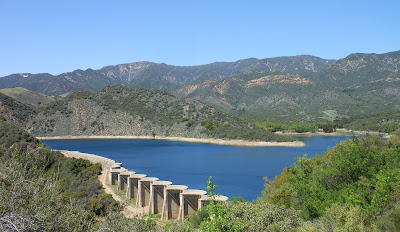
Juncal Dam and Jameson Lake
***We need Nominations for the Silver Honors Award. Please visit www.SilverHonors.com for more information....
Day #530 * Hike #609 * New Track #531
Saturday April 28, 2012
Jameson Lake & Juncal Dam - Santa Barbara, CA
Jameson Lake & Juncal Dam - Santa Barbara, CA
Dick Smith Wilderness
My Tripometer: Long Day * 7.25 Miles * +975 Feet
Intersection of Gibralter Rd & Camino Cielo Rd
Along East Camino Cielo Rd
Gibralter Reservoir to the left
Gibralter Dam
Amazing Ocean views!
This is a very long and windy drive. There are awesome views above Santa Barbara and the Channel Islands. For my camera, it was a bit hazy but being there was simply insane amazing. A picture cannot captivate the the feeling!
Turning onto Romero Camuesa Road
Nearly to our destination today...
Juncal Trailhead
Directions:
Starting at sea level in Santa Barbara, take the 101to exit 94A, Olive Mill Rd. Take Olive Mill Rd. about a half mile north and then turn left on Hot Springs Rd. About a quarter mile down, make a right onto Sycamore Canyon Rd. Follow Sycamore Canyon for 2 miles. Sycamore Canyon turns left, follow this an additional quarter mile and then turn right onto Foothill Rd/Stanwood Dr. Follow Stanwood for about 3/4's of a mile and then take a left to stay on Stanwood Dr. Drive a half mile further and then turn right onto El Cielito Dr. A quarter mile up make a left to stay on El Cielito and then an immediate right to stay on El Cielito. Less than a quarter mile further, take a right on Gibralter Rd. Finally, you begin following this long windy road all the way to the top! At 3468 Feet of elevation, you'll reach a T-Intersection as shown in the picture near the top of this post. Turn right on East Camino Cielo Rd following the road toward Big Caliente Hot Springs. Remain on this road for many long miles. This drive offers the most amazing 360 degree views! The road is narrow but paved and in very good shape. Eventually, you will reach Romero Camuesa Road. There is no street sign and only one way to turn. At 3014 feet of elevation, follow the dirt road down. In a short while you will reach a fork and you'll need to stay left to follow the road even lower. Mostly any vehicle can pass down this road but be careful because it is quite rocky and we were only driving about 15 mph. Sometimes the gates are closed so it may be wise to contact the Los Padres Santa Barbara Office for more details. Typically though in the summer months, the road will remain open and we followed it all the way down, crossed the creek and then parked at the Juncal Trailhead.
The drive from Santa Barbara took about an hour. We made many stops for pictures and climbed some towers for even better views. My tripometer reflects this adage. The hike we're about to do is quite easy but sorta lacks the excitement until you reach the dam...
Trailhead at 1786 Feet. 3 miles to the dam...
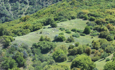
Green Hillside across the dry riverbed
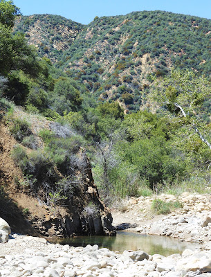
The kids wanted to jump in but I said no...
It was easy walking until the long uphill
Finally, the dam is in sight, only took an hour!
Looking back, still climbing...
From a viewpoint above the lake
Rather than take the split to the dam, we wandered around and above
No trespassing, well...
This is safe!
Found a boat and a couple swimming in the water
The water was cold but the kids went in. It was hard for them to get in and get out so they didn't do much swimming. There were large fish swimming here, but no fishing! What an amazing hidden place to visit! If you continue following the trail above the lake there will be a junction. If you turn right, you'll drop a few hundred feet and then climb 600 feet more over a mile and a half to reach a Alder, a small nothing camp. Or, if you remain on the road you'll reach Upper Santa Ynez Camp. This is 3.3 miles +500 easy feet from the Alder Creek Trail Junction (aka the Franklin Trail). You can also reach Santa Ynez from the Ojai side and I do plan on making an overnight out of this someday soon.
Regarding the Franklin Trail, last I heard is that the Friends of Carpinteria have raised $350,000 but need $450,000 to complete this trail to Carpinteria. The Franklin Trail is an old historic trail and it needs to be refurbished. --Dude, really, a half million to repair the trail. I know that it's in bad shape but common. This group is doing a good thing, I get it. They've been working on this for nearly two years now and the trail is still not open. Honestly, I could have done this myself for free and could have completed the entire trail over a six month period if I was at it each day. I would have only needed money for supplies. If I wasn't paid at all for the job, the task would cost only a few thousand dollars.
The problem with non-profits is, most of the money raised goes to administration. I understand people need to get paid to do this job but they shouldn't be soo greedy! I would have done it for $100k and I would have split that up between a couple buddies and supplies. --Okay, I'm done venting about it, go build me a trail so I can hike up and out of Carp!
Heading Back...
Adriane fell behind so we left him a sign with some water
Back at the trailhead
Pulled off the side of the road, Adrian was puking
The End!


Just wanted to say thanks for yor blog! I'm planning a two night backpack trip to the Santa Ynez area and your "on the ground" detail and photos are invaluable! I haven't been able find anything else on these trails. So, thanks!!!
ReplyDeleteHave a good and a SAFE Trip. If you have any direct questions about the area that you are going, please don't hesitate to email me directly at silverhonors@hotmail.com
ReplyDelete-JJ
Woah! I'm really digging the template/theme of this blog. It's simple, yet effective. A lot of times it's very hard to get that "perfect balance" between superb usability and visual appearance. I must say you've done a very good job with this. Additionally, the blog loads extremely quick for me on Internet explorer. Excellent Blog!
ReplyDeleteplaces to camp in santa barbara