Tuesday, August 30, 2011

Day 289: Las Virgenes Canyon Open Space & The Lazy Hiker Gone Mad...

Conejo

Day 289: Tuesday August 30, 2011
Lazy Hiker Gone Mad
Distance: 5.75 miles +550 feet
------------------------------------------------------
Part 2: Las Virgenes Canyon Open Space
Where: Calabasas, California
Trailhead

Directions:
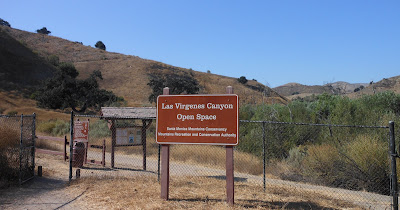
From the 101 Freeway in Calabasas, exit on Las Virgenes and head north.  Follow the road all the way to the end and you will see this sign.

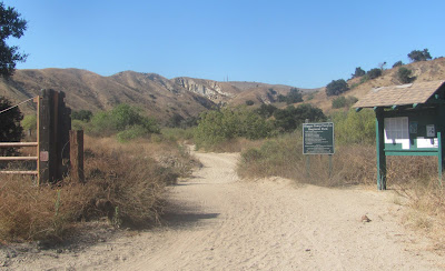
 This trail will link up with the Cheeseboro Trails

 I didn't have a map on me so I turned right (away from where I've been)

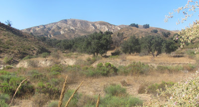
 Very dry open space; Extreme Fire Danger

 I took another right turn at the next junction
(Initially, this led lower into some needed shade)

Looking back at the shade below...

I didn't go too much further than this.  It wasn't too hot today, just low 90's, which is cool compared to how it's been.  My mission today was to look for the fire that burnt in the area over the weekend.  


Part 1: Gates Canyon Park
Where: Calabasas


I began my search for fire damage here.  I called the fire department and they advised that 4+ acres burned by Alizia Canyon & Las Virgenes.  I scoped out this park, which is off Thousand Oaks Blvd right down the street from Las Virgenes.  The hills piggyback up against Alizia Canyon  but there was no legit way to climb.  After a half mile of searching on foot for a trail, I decided to head back to the car.  ***This park looks really cool for kids---


I drove down Alizia Canyon Road to the end and into the apartment complex, still couldn't find any proof of fire.  So, I decided to hike the aforementioned open space.


Part 3: Lazy Hiker Gone Mad (Marathon Training)
Where:Ventura, California

When I came home from my Calabasas adventure today, the wife told me that we'll be running a half marathon on September 17th!  Ok---  I just weighed myself and I am 221.2 pounds.  I eat too much, I suppose drink too much and although I am hiking, with authority, I cannot shed the weight.  That is, until now.  We have two weeks to train -- We can do this.

Beginning right now, we ran 2.5 miles at Kimball Park (1 full time around and back +25 feet of elevation)

Quarter Mile Splits 
  • 2.25.56
  • 2.24.47
  • 2.16.40
  • 2.10.37  ***1 mile: 9.16.80
  • 2.16.87
  • 2.25.34
  • 2.21.82
  • 2.31.29  ***2 mile: 18.52.12
  • 2.07.62
  • 1.35.81  ***2.5 miles: 22.35.55
Jess was ahead of me by 8 seconds after the first quarter and then 20+ seconds by the halfway point.  As usual, I came back from behind and gave a little extra at the end.  I finished 33 seconds ahead of her.  This is no competition between her and I; we simply just have different running styles.  Ideally, I like to keep a steady pace, gradually increasing as I go and then sprint the end.  The stats above are not a good example of this because of the down hill on the back side and up hill running into the 2nd mile.  Jess always starts off too fast for me.  I could hang but I will pay for it in the end and my overall time would suffer.

My heart felt stiff on today's run--but everything else felt great.  I run often on the trails but unless you are given a good open surface, its hard to keep a good strong pace.  Running like this is the best way to get in shape, IMHO.... It's going to happen! 

Monday, August 29, 2011

Days 287 & 288: Magic Mountain & Ventura River

Look into the eye of a wild rattlesnake!

Day 288: Monday August 29, 2011
Riverview Trail (Ventura River at Oso Ranch)
Where: Ojai, California
Distance: 2 miles +50 feet
Time: 1 Hour  
 
 This guy was way LOUD!
(Look at the size of his rattler!)
 
Directions:
From the 101 Freeway in Ventura, take the 33 north to Ojai.  Beyond the freeway end, drive past the town of Casitas Springs & Oakview.  You will then enter the "fast food district" of Ojai.  At the next light, turn left on Baldwin (State Route 150).  About 1000 feet up, turn right on Rice (not white on rice).  You will stay on Rice for several miles.  You will pass the main parking entrance to the Ventura River area that I hiked on:
Keep going straight and when you reach Fairview, Rice will turn left and go down a small hill.  Turn left on Myers Road at the bottom of the hill.  The street turns to the right about 750 feet up but you will keep driving straight past the gate.  Go slow over the speed bumps because they are large.  There will be horses on your left and the parking area will be straight ahead:
 
 Today's Trailhead

I came up to Ojai today to drop off Domino at Rich's house.  Rich and his son Noah fathered Domino for several years while I was trying to adapt to California.  Domi has been doing pretty well lately.  She is walking better but she still needs assistance raising to her legs and I do pamper her.  Her reuniting with Rich and his dog Java should be great for her!

I was exhausted and sick feeling all day.  I spent wayyyy toooo many hours out in the sun yesterday and; ugh, I just felt horrible.  Fortunately, I arrived at the trailhead in the early evening hour where the temperature was not too nasty!  Once on the trail, I felt GREAT!  I could have walked forever but I didn't.  Ayden joined me for today's little adventure:

 We followed the Riverview Trail for awhile

 The main parking area is just up that cliff

 Refreshing

 Sammi Loved it!

 The first river crossing...

The first crossing was completely dry but in the rainy season, this fills up quickly.  We sorta marched in circles and never reached the remaining water holes.  However, some locals said that there was still some left over water out there yet after a very hot and dry week, much of the remaining water had evaporated.  Rather than go back to snap a picture of the water, we messed around with a rattler and then:

Entering Oso Ranch.  Wrong Way!  Turn Back...

Once you skedaddle away from the private area, the trails are pretty easy to follow.  There are many signs posted but the low end area around the river all looks the same.  Actually, I never intended to go too far today.  I am saving the Rice Canyon Trail and beyond for a day when I can dedicate the time...


Day 287: Sunday August 28, 2011
Magic Mountain
Where: Valencia, California
Distance: 7.5 miles +700 feet
Time: 10 Hours 


From 10am to 8pm; this was one long day!!!  The temperature reached a high of at least 105.  We did not just walk from ride to ride, we charged.  We circled the entire 26 acre park at least twice and climbed the big hill in the back 4 times!  If there wasn't an amusement park here, this would be prime hiking grounds.  No doubt was today considered a hike.  We all drank sooo much liquid yet it was never enough.  Dehydrated still from this crazy day!  It was a relief getting wet.  The roaring rapids did just that, but then my feet were soaked and -- BLISTERS!  I hate walking on concrete!  --I felt like a good though for awhile.  I rode on at least a half dozen roller coasters but I could not keep up with my 8-year-old.  Way too dizzy!  My favorite rides were Goliath and Apocalypse. 

Saturday, August 27, 2011

Day 286: Toro Ridge Trail (Upper) **New Camera!!!

Carpinteria Salt Marsh

Day 286: Saturday August 27, 2011
Toro Ridge Trail (Upper)
Where: Carpinteria, California
Distance: 3.25 miles +400 feet
Time: 1 Hour 

Directions:
From the 101 Freeway in Ventura, drive North to Carpenteria and exit at Santa Claus Lane.  Turn right at the exit and then an immediate left on Via Real.  Turn right on Toro Canyon Rd and follow this up for about a mile and a half and lookout for bikers.  Turn right into the Toro Caynon Park area marked by this sign:

About a mile up the road, park on the right an begin your mission:

Upper Toro Ridge Trailhead
I visited this area last week with my son but we decided to bypass the higher trail.  Unlike the lower trail, this route is in much better condition.  It's a bit overgrown yet easily accessible.


 Only 20 minutes to the top

 My new camera is clear and reveals the islands


 Time constraints; trail thick; my turn around point

Back through the woods on my way out

We have soccer games later so I had to turn around.  This was an easy climb but I did sweat like a dog because the temp was near 90 by noon.  The lower trail is mostly shaded but past the bench you are exposed.  It appears the trail continues for a long ways.  I will try to identify by Google another trailhead to complete this adventure on another day...


Day 284: Thursday August 25, 2011
Rustic Caynon Golf Course
Where: Moorpark, California
Distance: 3.5 miles +200 feet
Time: 1 Hour  
 
I returned to the foot of the trail by the Rustic Caynon Golf Course Sign at Campus Park Drive.  I jogged the easy dirt trail up to the course and then circled the 13th hole where I encountered squirrels, rabbits and dogs; yes dogs...  Easy footing on this day...


Day 285: Friday August 26, 2011
Terra Rejada Park
Where: Moorpark, California
Distance: 2.25 miles +50 feet
Time: 45 minutes 

After a long work week, it was just nice to chill and not do anything too serious.  This park is located on Mountain Trail Road and Terra Rejada.  I noticed it about a week ago when I elected to hike the County Trail Park.  I didn't run today.  I honestly wasn't feeling like my false chipper self today.  Nevertheless, the hour outdoors helped calm like kava ash...


Wednesday, August 24, 2011

DAY 283: Happy Camp Canyon Regional Park

Squirrel

Day 283: Wednesday August 24, 2011
Happy Camp Canyon Regional Park
Where: Moorpark, California
Distance: 7.0 miles +750 feet
Time: 2 Hours 
Trailhead at Rustic Caynon Golf Course

Directions:
From the 101 Freeway in Thousand Oaks, take the 23 North and stay on the freeway as it becomes the 118 East.  Just after the bridge, exit on Princeton Ave and turn left.  Follow Princeton an eight of a mile to the end and turn left on Campus Park Dr.  Continue straight into the Rustic Canyon Golf Course, you are now on Happy Canyon Road.  Drive back another mile and stay straight all the way back to the golf course.  Park your car and begin.
**I Google Mapped the area and discovered Happy Camp.  I found a pdf map: Happy Camp Trail Map  Problem is, I tried following the directions on the map on Monday and ended up somewhere else.  This was mostly the fault of me being on my motorcycle but nevertheless, I hit it up my way today.

Leading up to the trailhead, there is a dirt trail following the street that you can take if you want to extend the mileage.  I was not interested in this for I only had one water bottle and I'm still trying to get in shape.

Parallel the golf course for about a half mile
 100% dry area with many Oaks

 Easy slight up hill jog...

 Looking back after about a mile into it...

 The Gate

I generally jogged along the sandy first mile leading up to the gate.  Just after this junction, you will encounter a fork in the trail.  It appeared the heavier flow of traffic went right, so of course I tried my luck to the left...

 Found a few shady spots on this 90 degree day...

 During the rainy season, you can tell where the creeks are washed

 Slowly above the next easy hill leads to another valley

My turnaround spot

If I had more time and water, you can continue following the trail around to the right.  Next time...  The trail is deeply sandy in some places which may be great for horses but it slowed down my pace.  No big deal, it was still one of the easiest runs I have done, but damn it was hot :)  I jogged most of the way back and called it a day...


Day 281: Monday August 22, 2011
Happy Camp Rd
Where: Moorpark, California
Distance: 2.75 miles +250 feet
Time: 45 minutes 
Almost a trailhead

Directions:
Follow the driving instructions on the pdf: Happy Camp Trail Map  However, instead of turning right on Broadway, stay straight on Happy Camp Road.  Take this road to the end and then park,

There are no "No Tresspassing" signs, so proceed forward

 Stay on the main road passing the Edison split on the right


After the Edison split, you will intersect a T-junction.  Thee is an address pointing to the right, so I went left.  This led to the picture above and a locked gate.  I turned around and ran back to my bike.  This was a very easy journey in the wrong spot.  However, I did notice several other outlets from the road even before the trailhead.  They look like equestrian trails but I am good at dodging manure so I may have to try them.  Also, I believe they will connect to the back side of where I was originally trying to conquer.  Bottom line, there are many doable trails in these parts, unlike the nearby Balcom Canyon.  I just opened up a whole new map page to Ventura County...  Not sure why they call this place Happy, because its mostly sandy and ashy, but thank you Ash for making me find the happiness on these days.  Every hike is a new experience; ash or no ash :)


Day 282: Tuesday August 23, 2011
Arroyo Verde Park -- First Day of School
Where: Ventura, California
Distance: 3.5 miles +400 feet
Time: 1 hour  
 
It was the kids first day of school.  After work, I did a quick workout and then met up with the kids at soccer practice.  In the early evening, Sammi and I jogged to the park from my house and we cut across some new thistles up top to get back.  Yup, my legs are all scratchy and ashy now, but no big deal.  It's been a "Happy" week... 


Translate

ALEX'S LEMONADE STAND

ALEX'S LEMONADE STAND
Raising Money for Pediatric Cancer

RWANDA WATER HIKE

RWANDA WATER HIKE
Click Image to Learn More