Friday, August 10, 2012

Day 634: Fire on the Conejo Grade!

 Charred Mountain above the Grade!

Firefighters putting out the Hot Spots!

Day #634 * Hike #748 * New Track #618
Friday August 10, 2012
Fire on the Conejo Grade - Newbury Park, CA

My Tripometer: 1.25 Hours  * 2.25 Miles * +225 Feet
 Well, I can't go that way!

 Save my Hiking Trail!

 Firefighters act fast to contain the fire!

 Trailhead

Directions:
From the 101 Freeway in Newbury Park, take the Wendy exit.  If you are coming from the south, turn left over the bridge and then make a right turn at the light, Old Conejo Road.  If you are coming from the North, proceed straight across Wendy onto Old Conejo Road.  Follow this street all the way to the end where it rounds to the right.  You will immediately see the mobile home community on the left.  Turn in and then make your very first left turn.  Take this to the end and then turn right at the little stop sign.  You are on Monte Vista.  Follow this to the end.  You will see parking spaces on your right and the trailhead is at the end of Monte Vista.

 Take a step down and begin

 Well then, there is a trail here!  Wahoo; let's go find a fire!!!

 Looking back over my first few steps, passing a wooden cross
(Possibly a family pet buried there?)

 Good Work Guys!  I'll be right there!

 The trail is easy to follow

 I smell it, I see it, I'm slowing down.  Should I be here right now?

 The road to the right, that's where all the firemen are...

 So, I'll take this Edison Road to the left

The Firefighters did a great job here.  The fire did not jump over the road.  They contained it very well.  I'm pretty sure that they saw me but I quickly began walking the other way.  I heard one say, "...he was smoking a joint".  Not sure if this pertains to how the fire started or if he was talking about his son.  More than likely, the fire started at the 101 Freeway from a car.  It happens nearly every year!

 I turned left away from the fire, you can hike this into Camarillo...

 Camarillo below...

 I made another left following an, animal trail?
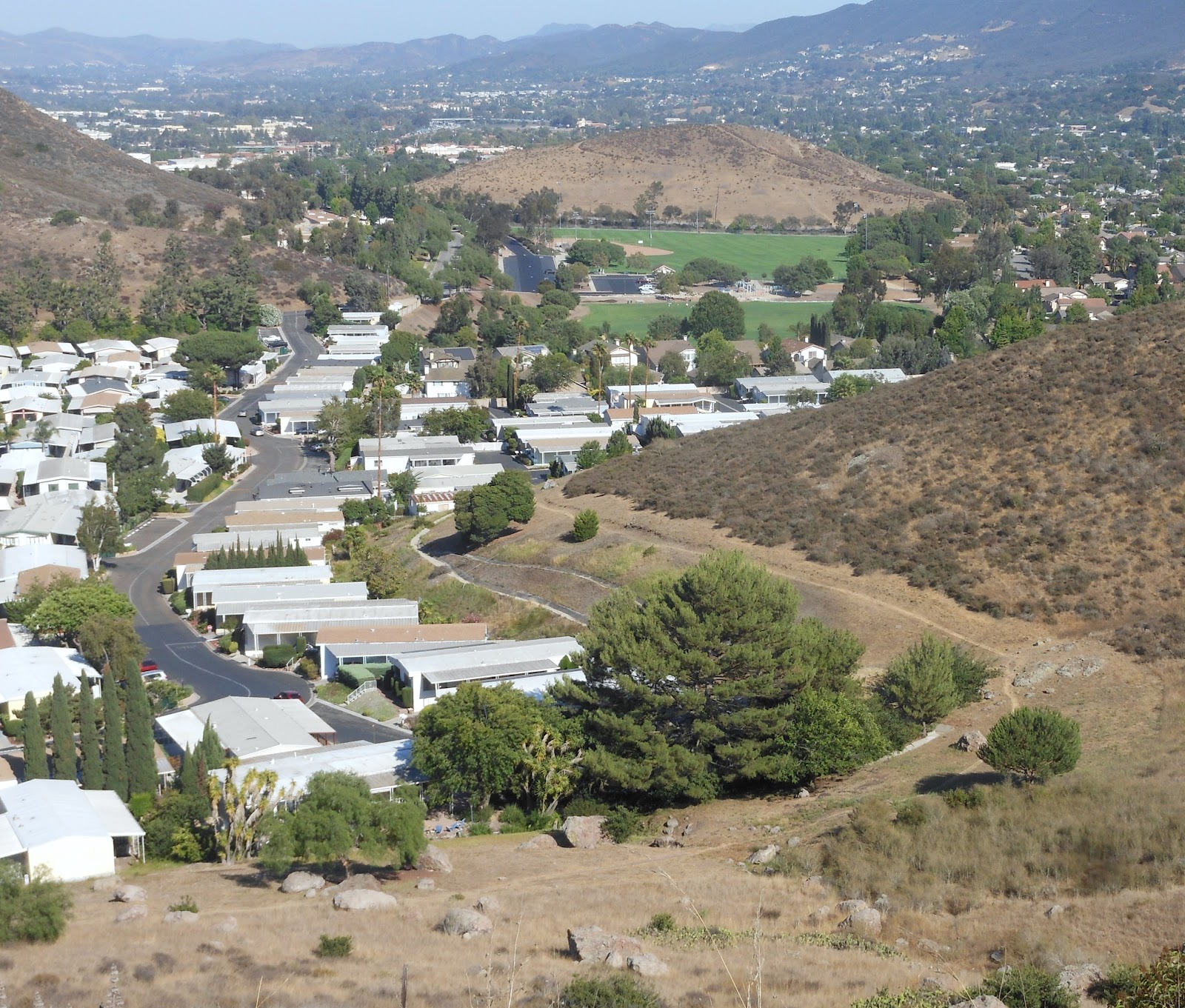
 The trailhead is down below

 Let's try to gain a better vantage point

 That works!

 Hey Guys; Over Here!

 All the way back to the Edison Road. 
The coast is clear, I'm hiking up there...

 The hot ground is charred, the trail is gone.  Tip Toe across...

Flashback; I was here Day 5: Camarillo Springs Trail

 Hey, I'm over here now.  Come get me :)

 Heading back, I came up from the right path, so let's go left

Well, the trail was promising but then it ends at a cement drainage runoff.  I followed that and then looped back to the trailhead.  I decided to keep going to see if there was a more legit way to enter this area...

 My motorcycle parked below

The trail turns and faces Boney Mountain
Good enough for me today.  Thankfully, it wasn't that hot!  Probably 90 degrees, which is like 15 degrees cooler than where I hiked a couple days ago.  I am updating this one out of sequence due to the current event.  It has been one long HOT week and I have lost 7 pounds by accident.  --I'll take it!

Wednesday, August 8, 2012

Day 629: Silverstrand - Port Hueneme - Dallas Cowboys

Silverstrand Beach, from the Jetty

Day #629 * Hike #742 * New Track #613
Sunday August 5, 2012
Silverstrand - Oxnard, CA

My Tripometer: 2 Hours  * 1.75 Miles * +25 Feet

 Pepe's - Best Food in the Strand!

 Trailhead - Beach Entrance!

Directions:
From the 101 Freeway in Ventura, exit on Victoria and head south into Oxnard.  Take Victoria all the way to the end, all the way :)!  You will pass Port Hueneme Naval Base on the left.  The main beach entrance is to the right at the town's stop sign, but I prefer turning left.  With Port Hueneme on your left, follow the road all the way to the end.  Turn right and, huh?  The old beach entrance by the Jetty is blocked off and completely covered in sand.  No big deal.  Find a spot on the street and park.  There are public walkways between the houses.

 Ayden Chasing Birds

 Ayden Dodging Waves

 I hike out to the Jetty; islands are fairly visible

 Port Hueneme - Do Not Enter!

 Hueneme Pier

 Silverstrand Wall, from the old parking lot


 What do these kids see?

 A dead seal :(

 The main beach, a mile away

 The channels

 Rooftop Open House - $3.25 Million!


Day #629 * Hike #743 * New Track #614
Sunday August 5, 2012
Dallas Cowboys Training Camp - Oxnard, CA

My Tripometer: 1 Hour  * 1.25 Miles * +25 Feet


We arrived late and practice was over.  I walked with the kids around the park and made sure that I extended the course beyond a mile.  It would have been cool to see the practice, but what are you going to do...

Monday, August 6, 2012

New Track 612: Twin Pines Big Spring Alamo Mountain

Sammi chillin at Twin Pines, elevation ~6700 Feet

Day #628 * Hike #741 * New Track #612
Saturday August 4, 2012
Twin Pines - Gorman, CA

Big Spring - Alamo Mountain
My Tripometer: 2.5 Hours  * 1.25 Mile * +100 Feet

 Lunch Time!

Directions:
Follow the driving route from my previous hike to Day 628: Little Mutau Trailhead.  However, when you reach the 17.9 mile mark, turn right on the dirt road towards Dutchman.  Travel only 0.4 miles and then make a sharp left up the road.  Twin Pines is another 0.4 miles up.  The road is a bit rough but any front wheel drive car should be able to handle it.

 Great Spot to Camp!

I came up here several years ago and camped here with my wife and kids; and Domino (this was before Sammi).  If you are going to camp next to your car, this really is one of the coolest and isolated spots to go to.

 I see someone has been shooting bottles

Hearing the occasional gunshot in the area is not abnormal.  I ran into a couple of guys who were hunting wild pigs.  I didn't even know they existed around here; probably not at this elevation.  The circled around the camp and told me how a dry lightning strike hit a tree the night before.  It caused a fire but the Los Padres Fire Service was on the job and with a real long hose, the put it out.

They seemed excited to see me and shared their findings.  They found a Chevy Avalanche over the side of a cliff.  They hiked down to it but nothing was worthwhile in there.  They estimate that it happened only a few months ago.  The Avalanche is now part of the mountain for life.

They also told me of a place called Big Spring, which is just below this spot.  I had seen it on the map and I was intending to go there anyway.  I will detail more about that spot later in this post...

 Various ways to hike; doesn't go anywhere

 Views of Mt. Pinos across the way

I hiked less than a mile here but due to the elevation and my exhaustion from the earlier hike today, I felt spent.  Nevertheless, I wanted to extend this experience into a hike so I included Big Spring...

 The road to Big Spring

Directions:
Following the directions above, just before you reach the top of the hill at the 17.8 mile mark, you will see this cut off to the left.  The road is feasible to drive but I chose to park on the main road and walk down.  The decision was made easy by the other guys.  The advised that the road is narrow in spots but I should be okay.  When they left Twin Pines, the barely made it up the hill to get out.  They could have easily remained on the main road out but decided to take the steep side shortcut to get out.  Their 4x4 was challenged but eventually they made it.

 Views from the road walking down

 Sammi drinking from the spring

I didn't try the water but it sure did look good.  It was cold and Sammi couldn't get enough!

 The rocky ledge and trees above

 Further back, another amazing spot to camp!

 Animal Trail...

The other guys trekked down this route to the southwest for about a mile.  They claimed they encountered a bear den.  They marked the location by GPS on their phone.  There was large scat near the den and both dudes fit into the sleep away quite easily.  I may have to return here some day to check into this finding.  However, the time was getting late and I was satisfied with my hiking progress for the day. 

 Fresh Pines up here; clear-clean air.  Love It!

Views heading off Alamo; a long car ride home awaits...

Translate

ALEX'S LEMONADE STAND

ALEX'S LEMONADE STAND
Raising Money for Pediatric Cancer

RWANDA WATER HIKE

RWANDA WATER HIKE
Click Image to Learn More