

DAY 207: Happy Valley & Fairy Land
Date: Thursday June 9, 2011
Miles: 7.0
Elevation Gain: 1800 Feet
Time: 2 hours
Difficulty: Easy trail but long and rollercoastery
Reward: I found Happy Valley & Fairy Land
Description: Following the old dirt roads while being stalked by a hawk!
Where: Newbury Park, CA
Directions:From the 101 Freeway in Thousand Oaks, exit on Rancho Conejo Rd and take it past Amgen near the end. Turn left on Conejo Center Road and then drive a quarter mile down and park. On the right look for:
Directions:From the 101 Freeway in Thousand Oaks, exit on Rancho Conejo Rd and take it past Amgen near the end. Turn left on Conejo Center Road and then drive a quarter mile down and park. On the right look for:
Trailhead (Arroyo Conejo Gateway)
The first time I hiked on this mile stretch of dirt road was Day 82 when I first climbed Mt. Rex. Today, take the road to the bottom of the hill (a drop of about 300 feet). Then stay on the main road pass the other options; Achilles Heel Trail & Abandoned Car Trail. You will wind around the turn and begin gaining elevation again. At this point, I have been jogging the entire time. In the distance on your left will be the bold Mt. Rex. Then on the right you will see:

Happy Valley
I met John the other day and he told me about Happy Valley. I assume this is what he was talking about. Rather than taking the trail through the valley, stay on the main road. In a moment, there will be a fork in the road. I took the right fork which lead me higher. I climbed to the top and shot this pic:

Happy Valley Lookout
The trail appeared as if it was going to continue on forever. It went lower and then higher to what I believe is considered Mt. Conejo. I decided to turn around today because I wanted to find Fairy Land. The trail that I came up from was on the left, but if you will encounter a fork option to the right which I assumed would also intersect the main road that I was on prior to turning up to the Happy Valley Lookout. I remembered John saying that Fairy Land overlooked the weigh station. He explained that you follow the utility poles, so that's what I did:

Utility Pool Trail
I was right, I did intersect the road. It was a 5-way intersection. I figured to go straight. To the left would be my way home. To the right will lead me lower and likely take me to Camarillo Oak Grove Park. In fact, I believe on Google Maps, this road is known as the Camarillo Oak Grove Fire Road. Soon enough I will connect all the dots and then publish the map to the blog... There was also a single track trail leading up to the left, but I left it alone. Possibly, that would lead to Mt. Rex, but I don't know that for sure. So, I kept on following the utility poles. I was fooled once with a fork in the road; I took the upper that led me right to the poles and then the road ended! No big deal, take the right lower road and then like a roller coaster, back up again. Finally, nearly to the top:

Overlooking Cam. Oak Fire Rd? -There's people on horses by the tree

The trail that I just came up

Destination Point, there was a Hawk screeching every few seconds

Fairy Land & Cam Oak Grove Park in the back...

The long distance shots with my camera are nearly worthless. I'm still haunted by Day 93: Broken Camera Trail! It doesnt help with the hazy June Gloom...

Hmm, maybe I can reach Mt. Rex from here and go home that way...

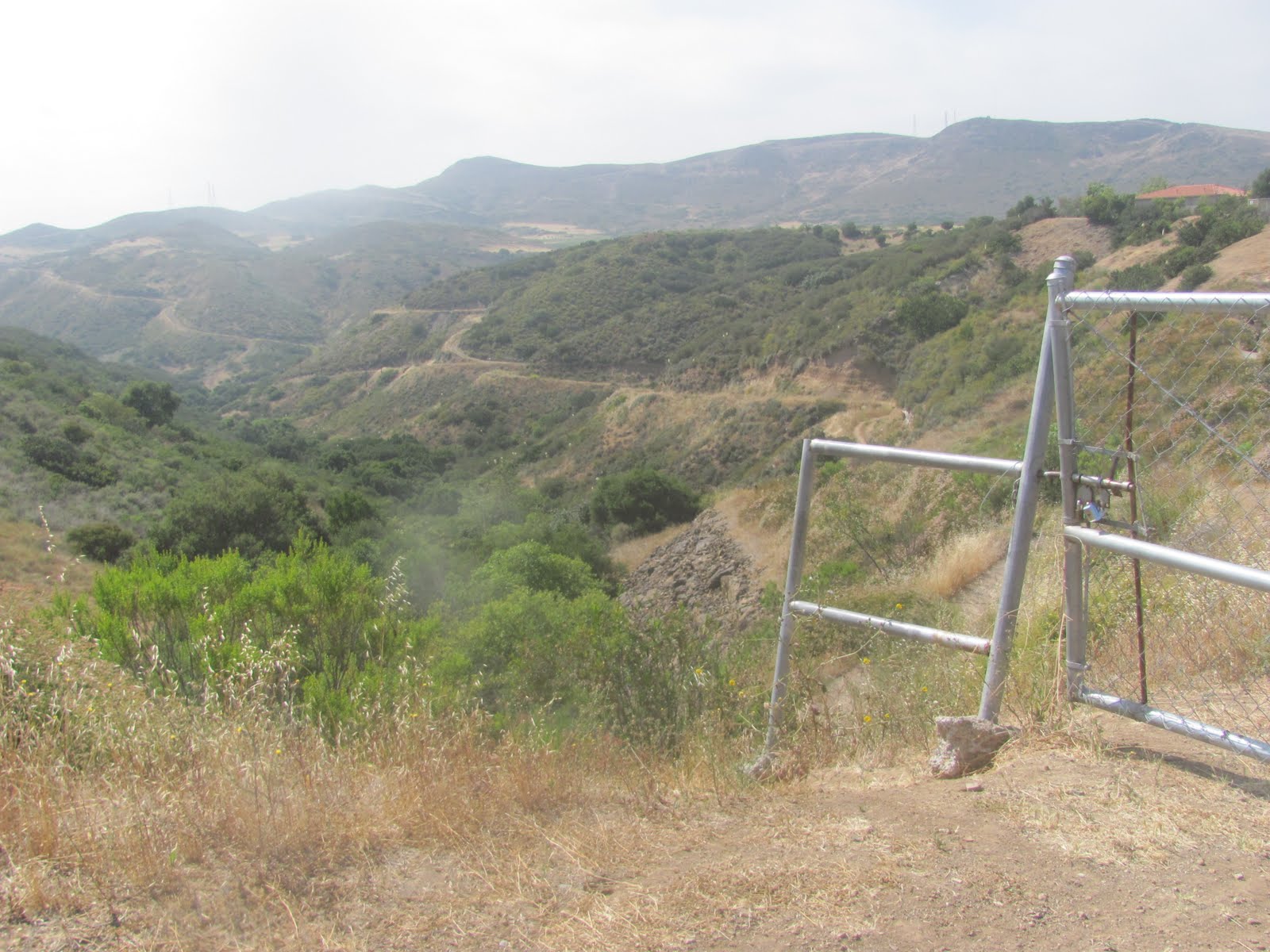
Thru the fence...

Weigh stations

And NO!
This is where I stopped. There was a trail for a moment but from here it became far too steep and my legs were getting all scratched up. I thought I remembered John saying something about following the fence, but it wasn't worth it. I was over an hour into my total travel at this point and I had a hawk circling over me and screaching every few seconds. What was his problem! Anyhow, I turned back and ran most of the way back. Good deal that the temperature has been maintaining 7 degrees below normal for this time of year. Perfect weather for a hike!
What Happened to Day 206?
Let me tell you. I thought I was just going somewhere to connect some dots. I didn't think it was going to be anything special so I didn't bring my camera. However, WATERFALLS, CANYONS and a tunnel through a rock leading to a private water hole. All this just 5 minutes from my job and only a 5 minute hike to reach the cool stuff. Ha; I had my phone on me and snapped some pictures. Now I just need to figure out a way to transfer this to my computer. Give me a couple days, I'll post the good stuff!!!


geeliiu89od
ReplyDeletegolden goose outlet
golden goose outlet
golden goose outlet
golden goose outlet
golden goose outlet
golden goose outlet
golden goose outlet
golden goose outlet
golden goose outlet
supreme outlet