Monday, February 11, 2013

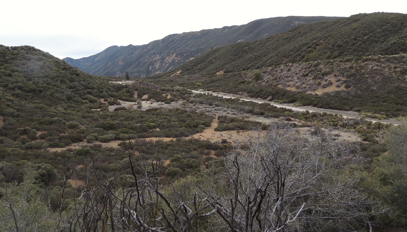
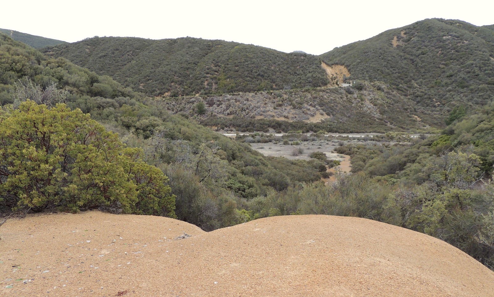
Day 816: Flat Rock - Matilija Wilderness - Views of Caro Blanco

The Matilija Wilderness
 
Day #816 * Hike #1020 * New Track #802
Saturday February 9, 2013
Flat Rock - Matilija Wilderness - Ojai, CA

Views of Caro Blanco
My Tripometer: 2.75 Hours * 6.25 Mile * +650 Feet

 Welcome Back to Matilija Canyon Ranch
Elevation 1515 Feet
Directions:
Follow the driving directions from Days 523-524: Camping on the Matilija Trail.  On today's hike, follow the dirt road (trail) straight back past the peacocks and the private residents...

Today's blurry map
(of course I left the map at home again)

 A couple of easy creek crossings

Beware of Germans... 

I was up here with Ayden just last month: Day 775: Murietta Divide.  Today we continued past the three German Shepherds at the Blue Heron Ranch.  We were not followed by them this time...

 Making our way back here...
 

The road narrows and becomes a trail
Views of Caro Blanco Elevation 4860 Feet

 Fork in the road, which way do we go?

Stupid me, I leave my map and home and don't even bother looking at it before we go.  Either way would have been fine, so we chose right because it seemed to head toward the creek.  Our destination today was to reach the Matilija falls.  This junction is 2.4 miles from the trailhead.  We did it in under an hour.

 We spotted a side trail to the right, leading to the creek...

 We discovered Flat Rock!!!

 Awesome Chill Out Spot

 Sammi takes a dip

 Back on the trail

 Camping area!  This is not marked on the maps


We explored for awhile, found two tents and assumed that they were there Friday night and day hiking it up to the falls.  We are on our way; maybe...


Rather than follow the creek, we climbed this bluff.  Maybe it was an animal trail but it weaved through the thickness up there and eventually lead to a legit trail.  For some reason, I chose left thinking that the trail would wrap around the hill and then meet back up with the creek at a higher point.  Well, I was wrong!

 Looking back on what we've done so far

 Heading back down, into Poison Oak???

This trail intersected the junction from earlier.  So, I guess we are heading back.  Next time I plan to mountain bike the trail until about this point.  I'll bypass the creek section of the loop and remain on this trail instead.  Right around here, I'll lock up the bikes to a tree.  From the picture above, the falls are about 2 miles further and will gain you another 600 feet.

The entire wilderness has so many possibilities.  This would be a spot to come back to many times and then explore off trail to really take in the undiscovered.  I will return for sure!

 Looking back - Flat Rock is in there somewhere :)

Blue Bird!
 
Rewind:
The past few days I've been finding unique places to hike and spread the word around about Chill Out.  That said, I am out of fliers and we now need to find a new marketing mechanisms.  I did have one duplicate hike at Arroyo Verde mixed in there, for the record...

Wednesday, February 6, 2013

Day 812: Falling Short of Laguna Peak

Laguna Peak - Property of the US Navy

Day #812 * Hike #1016 * New Track #799
Tuesday February 5, 2013
Falling Short of Laguna Peak - Ventura County, CA

My Tripometer: 0.75 Hours * 1.5 Mile * +25 Feet

 Laguna Peak Road

Off Route 1, the PCH, just past Las Posas, I turned down a small road, Caryl.  My plan today was to hike up 1400+ feet to Laguna Peak, but as you can see, there's no way I'm going to mess with the Navy.  Instead, I drove down the road back there, up a hill and I parked here:

 Trailhead through the Lemon Orchards...

Birds chirping, no workers around, very pleasant
 
 This road wen on a ways...

 And this road

 Hiked back further into the orchards

 
Okay, so I shouldn't really be back here, and I know this, but I need new tracks and I'm running low on real estate.  For the past few weeks I had been hiking through the streets of Port Hueneme handing out fliers.  Well, 5000 fliers later, I'm out of fliers and streets to hike.  So here we are, another Day in the books...
 
 Views from the road heading back down...


Monday, February 4, 2013

Trapped by a Mountain Lion

Trapped
by a
Mountain Lion
 
 
Synopsis
An unpretentious teenage boy faces calamity which changes his life forever.  Accompanied by his sister, the two siblings are forced into an unknown terrain testing their courage, will and stamina. Relying on spontaneous instincts and hope, they must fight for survival and conquer the dread of the mountain lion.  


***I'm writing a book, again.  This time I will share it for free online chapter by chapter.  I'm dedicating a tab to the top of my blog so check back every so often to see how it turns out...
 
 
-Jeremy Jacobus

Sunday, February 3, 2013

Day 809: Howard Creek Tailhead - Rancho Grande - Waterfall off the 33

Waterfall off the side of the 33

Day #809 * Hike #1011 * New Track #794
Saturday February 2, 2013
Howard Creek Trail - (Not Quite) - Ojai, CA

My Tripometer: 0.75 Hours * 1.25 Miles * +175 Feet

 Trailhead - Not what I was looking for 0.2 miles on the right from the 33

Directions:
Take the 33 North out of Ventura and past Ojai.  Drive through the tunnels, past Wheelers Gorge and take Ventura's most scenic drive all the way up to Rose Valley.  The drive is about 20 minutes from Ojai.  Turn right on Rose valley and this incorrect trailhead is on the right.

 The orange streaks on the left represent the wrong hikes that I took today


 After wandering around, we found what appeared to be a trail?

 Okay, we can't figure this out?

 We climb higher!

 Dead End!

We came back down from the ruff and then spotted this alternative to the left

 Many bullet shells!

 Glass Broken Everywhere!

 Shot Up Can!

 Reached another Peak; another dead end!

 Ocean Views!

 Manzanita

Day #809 * Hike #1012 * New Track #795
Saturday February 2, 2013
Howard Creek Trailhead - Ojai, CA

My Tripometer: 0.5 Hours * 1 Mile * +75 Feet

 The Correct Trailhead for the Howard Creek Trail

So this is what happened.  Before I hiked in no mans land with broken glass, I drove up here first.  I saw the gate, looked at the map and figured this was Ranco Grande.  So, I drove back and tried my luck with no success to hike through the thick.  Anyhow, this trailhead is 0.4 miles from the 33 Highway, just 0.2 miles from the wrong trailhead.

 It would appear that the Howard Creek Trail veers off to the left


With a commitment to get back to the Chill Out Fro Yo Shop, I knew I would not be able to complete the 5.6 mile round trip excursion.  Therefore, I went straight on this road and wound up here.  It was a big loop...

 A switchback on the Howard Creek Trail

 Sammi finds a puddle of water on our loop

 Cool pine trees and trail near the gated parking area

After this short hike, I drove another 0.7 miles up the road to identify Rancho Grande:

 1.1 Miles from the 33

I didn't hike here but I drove up to Rancho Grande to confirm and understand the map.  Now that I know where the Howard Creek Trail is, I will return and do this right.  Sometimes it's trial and error...


Day #809 * Hike #1013 * New Track #796
Saturday February 2, 2013
Random Waterfall off the 33 - Ojai, CA

My Tripometer: 0.5 Hours * 1 Mile * +125 Feet


On our drive back to Ojai, I decided to stop at this waterfall.  I've seen it many times in the past and today was the day to finally check it out...

 It's a tough narrow trail, but it's manageable

 It keeps going past the waterfalls...

 Okay, we're turning back

I ran into a couple of others who were trekking down from here.  They said the trail diminished just ahead of here so it just made sense to turn back...

 Heading back down...
 
 
Rewind:

Each day during the work week represented a new hike through the streets of Port Hueneme.  I covered nearly the entire city and of the 5000 fliers that we started with, I have less than 100 remaining.  Mission accomplished and business is doing Great!

On Friday, my new track was to Golf N' Stuff in Ventura.  This is hardly a hike, or is it?  We played 36 holes of putt-putt and then walked around to endure well more than a mile.  I beat Ayden in both matches and at one point, I achieved two Hole In One's in a row.  Dang, almost makes me want to Golf!
 

Saturday, February 2, 2013

Mt. Whitney - Day #1000

I just entered the Lottery for Mt. Whitney.  My Day #1000 will be Monday August 12, 2013.  Ayden does not want to go but I still reserved it for 2 hikers regardless.  I'll be honest; I'm scared!  I haven't been hiking any considerable distance or elevation lately.  I'm fat again, I'm not running, my Florida vacation with zero elevation gain was no help.  Excuses, Chill Out - this business is cutting into my sleep and conditioning.  I'm anxious, nervous -- A freakn mess!

Somehow, someway, I need to hike Baldy and others out there in San Bernadino to condition for this.  At age 38, I know that I will need more than two weeks to get ready for this.  One thing on my side, I don't smoke.  Thank God, huh.  I have heart, will, passion.  I'll reach deep and make it to the top, even if I have to trek it alone.  Maybe I actually prefer to do so.

Here are the details.  Cross your fingers; They Have To Pick Me!!!!

National Recreation Reservation Service (NRRS)
#6-1354586
Confirmed
Mt. WHITNEYLottery: Mt Whitney Lottery 2013
Permit Type: DAY USE of Mt. Whitney Zone
Preferred Trail/Zone: Mt. Whitney Zone- Day Use All Routes JM34.5MWZ
Preferred Entry Date: Mon Aug 12 2013
Group Leader: Jeremy Jacobus
Preferred Group Size: 2
Lottery Fee (Non-Refundable)6.00
Total:
6.00
National Recreation Reservation Service (NRRS) Total:Payment Method: American Express xxxxxxxxxxxx1009
This payment will appear on your statement as: Recreation Gov 888-4481474 NY
Subtotal:
$6.00
Total:
$6.00
Amount Paid:
$(6.00)
Balance:
$0.00
 

Friday, February 1, 2013

Vote for CHILL OUT!!!

$2,000.00 Grand Prize!

Follow the link below and VOTE for Chill Out!  The Ventura County Star is giving away $2,000.00 in Cash to three random voters...


You're not voting because you think you're going to actually win.  You're voting to help us out!  Although there is a chance you can win real money, the real initiative here is to help us out!

As most of you know, those who follow my blog, my wife and I recently opened up a Frozen Yogurt Shop in Port Hueneme, California.  We call it, Chill Out Frozen Yogurt & Panini's.

In the two weeks we've been open, customers who have discovered us are loving this spot.  Port Hueneme lacks excitement and we're making a difference!  Hot Panini's are flying off the shelves and who doesn't love frozen yogurt.

The local newspaper is holding their yearly poll and the winners of each category will be recognized with a plaque and free press in the newspaper.  As a new business, this exposure is priceless.  Especially considering that the only marketing we've done is from when I hike around the neighborhood to hand out fliers.

This is what you do.  Go to the site and type CHILL OUT in the four categories that we are going for::

Ice Cream/Yogurt Shop
Lunch Under $7
Sandwich
Take Out
 
To submit the form, you will need to pick 10 total categories so just choose something random on any random category.  Of course, if you do have a favorite something, Vote for it :)
 
My wife and I are a small mom and pop shop.  We were not backed by any investors.  It's just us, hard workers, parents, coaches, day care providers and of course, Hikers!
 
The ballot box closes on February 10th so please cast your votes right away.  Please tell a friend.  Tell everyone you know.  One day, you will be in Port Hueneme and you will be glad you stopped by Chill Out Frozen Yogurt!
 
 
Our business website is: www.ChillOutFrozenYogurt.com
 
 
**Thank You everyone.  Just ask, I will return the favor.  Let's go on a hike and eat some FroYo...
 
-Jeremy

Translate

ALEX'S LEMONADE STAND

ALEX'S LEMONADE STAND
Raising Money for Pediatric Cancer

RWANDA WATER HIKE

RWANDA WATER HIKE
Click Image to Learn More