Thursday, September 22, 2011

Completing Days 300 - 309: Cozy Dell Trail


Going to war?


Day 309: Monday September 19, 2011
Cozy Dell Trail
Where: Ojai, CA
Total Distance Today: 3.5 miles  +700 feet


Directions:
From the 101 Freeway in Ventura, take the 33 North to Ojai.  If you know the La Luna shortcut, great, otherwise follow the 33 North past Meiners Oaks.  Only a few miles out of the residential area, you will see the Cozy Dell trail sign on your left.  Park on the left.  The trail is across the street on the right.  If you have kids or dogs, keep them close because the cars will zoom down the roadway.

 Nice shaded trail

 Steady easy uphill for a little over a mile...

 no resting...

 look out for the rock...

 about a dozen easy switchbacks

 I did this less than 48 hours after my half marathon

 ahh, with ease...

 the top, or is it...


From here, we saw the men with guns hiking up on a single track off trail.  The route they took was not marked on the map but it appeared easy to follow, albeit, straight up...  After enjoying the scenery from this vantage point, we continued down on the main trail.  After dropping a hundred feet, it climbed back up again and met up with another side alternate high trail.  My guess is that you can loop the hill to the left.  The warriors were carrying snipers so Ayden and I kept low...

We turned around shortly after, which was disappointing because the trail would have intersected a dirt road in less than a quarter mile.  From the 33, the road is only 1.9 miles, we probably covered 1.75 of that.  However, we had to get back before sun down, it was a school night and I still had to pick up Domino.  I've been leaving her with my buddy Rich who lives in Ojai; one week on, one week off.  I think it's good for her because Rich was a major part of her life and I know his son appreciates it...


***REWIND:

Day 300: Saturday September 10, 2011
Above Calle Arroyo
Where: Ventura, CA
Total Distance Today: 2.5 miles  +200 feet
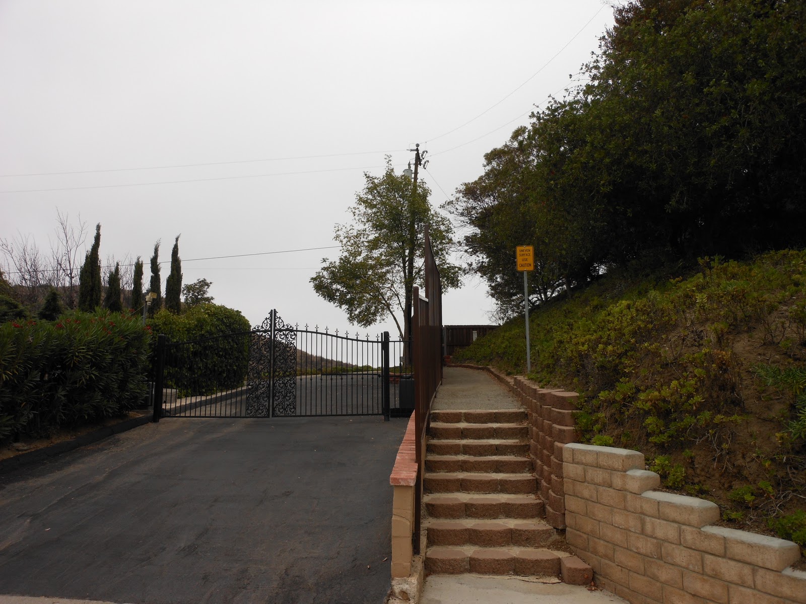


A few months back, I hiked from my house out of the Arroyo Verde Park and into the open space.  After going up and over and around through some nasty thick, I pleasantly settled down to a switchback of avocado trees.  Of course, this lead to private property but beyond the fence appeared to be another hill with trees and no thistles.  Well, on this day, I was in search for a legit way to trek the open space.  FAILED!  I refused to go down the residential driveway, but I did find a gated community of sorts up here.  The driveway was fenced and concealed but the walkway was open.  So, Sammi and I walked through the gate which lead to a short fire road.  On the other side of the road was the Colina Vista area.  There is no way to drive to this neighborhood from up here.  You only other option is to drive down to foothill, around and back up again.  Unfortunately, the trail portion of my walk today was only about a quarter mile total, but I did stroll the streets up here for some time in search for another public opening.  In fact, I found one!!  Yeah, I discovered this nearly a year ago with Alyssa when we eventually decided on a night hike at the Kimball Park Tunnel.  Bottom line, there is no legit way to hike into the hills unless you are hiking out of Arroyo Verde or you know someone living up here.  Still searching...


Day 301: Sunday September 11, 2011
Ventura Missionary School
Where: Ventura, CA
Total Distance Today: 2.0 miles  +100 feet


***A moment of silence for the 10-Year Anniversary of the 9-11 Tragedy...

On this day, Alyssa had a soccer game and as a tribute to the disaster, I edited the game and published it to YouTube.  If you are interested in watching this game, please check it out:


---Later that day, I decided to keep searching for open space access in Ventura.  The Ventura Missionary School is off foothill just before Kimball.  Pretty much, the fence is locked and separates you from the wild land.  I tried, I found a way to wander a bit and hopped a fence.  However, I cannot recommend it but at least I scratched this location off my list and hiked another day.


Day 303: Tuesday September 13, 2011
Los Robles Trail
Where: Newbury Park, CA
Total Distance Today: 8.0 miles  +600 feet


***NO PICTURES!!!  Today was my last big push before the upcoming half marathon.  I hiked/jogged the section off Morepark Road and then to the west.  I have been back here before but I never raced all the way across to the other side, until now...

Fortunately, I uploaded everything from my camera through Monday the 12th, including the Soccer Video.  This information was stored on my hard drive but after my hike on Friday the 16th, I uploaded again and was going to update this blog.  However, when I tried making the Soccer Video, I accidentally uninstalled my computer's registry, in addition to several other things including pictures...  The mistake cost me over $200 to fix.  This all happened because my new Nikon Camera was not compatible with Microsoft Movie Maker.  SO FRUSTRATING!!!...  Finally, I got the computer back, found a way to convert the videos and here we are now... A week behind updating the blog but still hiking...


Day 304: Wednesday September 14, 2011
Chumash Park
Where: Agoura Hills, CA
Total Distance Today: 2.0 miles  +25 feet


Nothing special about this place.  Just an easy going park.  I took some nice pictures, but they were erased. No big deal.  At this point, I just joggd about a mile and then walked a bit just to keep the legs loose in preparation for the big run on Saturday. 


Day 305: Thursday September 15, 2011
Sumac Park
Where: Agoura Hills, CA
Total Distance Today: 2.0 miles  +25 feet


Much like Chumash Park, Sumac is off Kanan just one block up.  I had seen signs for these parks many times on my recent voyages to the open space further up the road.  Between Chumash Park and Sumac, Chumash is better for kids but Sumac was better for me.  After jogging the oval cement path, I wandered out of the park and discovered that this too lead to open space.  First you have to cross the soccer fields.  I decided to not tempt my curiosity because in just 2 days, I would be running and the last thing I needed to do was wear my legs out with a climb.  --Speaking of soccer fields, Alyssa's game was at a crummy soccer field set up at the elementary school set up across the street.  Why didn't they play here?  These fields were in much better condition...


Day 306: Friday September 16, 2011
Morrison & Forrest Cove Parks
Where: Agoura Hills, CA
Total Distance Today: 1.5 miles  +50 feet


Off of Thousand Oaks Blvd is Morrison Park.  Small, but the grass is green.  There is no open space access here.  I crossed T.O. blvd and found Forrest Cove Park,  Neat and shaded area, nice homes and there is a small section of space back here.  I kept it real easy today, no jogging, just walked.  The half marathon would be the next day.

****More updates later, still trying to catch up....  At least now I have pictures...

Sunday, September 18, 2011

Days 302 & 307: Big Rock/Half Marathon

Beneath Big Mugu Rock

***What a week!  Computer crashes, lost many pictures but I ran a half marathon and continued hiking everyday!!!


Day 307: Saturday September 17, 2011
Wounded Warrior Half Marathon
Total Distance Today: 14.75 miles  +75 feet


I thought it would be fun to take the lead in the 13.1 mile run.  With Jessi running on my right, we ran one, two down the first stretch.  Then, reality sets in and if I am going to complete this race, we're going to have to allow the pros take over.


  • Mile One: 8.46.03


Still too fast for my blood and this condition.  I weighed in at 218.7 pounds!  Way too heavy.  As runners continued to pass one by one, I continued to slow down but Jessi felt the urge to keep moving.  By the 2nd mile, she was a good 20 seconds ahead of me.

  • Mile Two: 9.27.06
  • Mile Three: 10.10.15
  • Mile Four: 10.03.50
  • Mile Five: 10.07.45
  • Mile Six: 9.47.27
Jessii was in my sights at almost all times, but she probably was running about a minute ahead of me after the 5th mile.  If she wasn't pushing the pace, I probably would have been running these miles even slower.  However, on a long stretch of flat pavement, I decided that enough people had passed me so I was going to take a stand.  A couple of 6 foot+ runners, father and son, had passed me and I began to draft off their pace.  Jessi was slowing and by mile six, we reunited.  However, that was short lived.  Although she's shorter than I, her pace strides are longer.  It was still too early for me to expend a continuous run stride so I shortened up again and formed another 1 minute lead.
  • Mile Seven: 10.16.22
  • Mile Eight: 9.17.59 
I was feeling great and caught her on mile 8.  Come to find out, she was spent.  Meanwhile, I was ready and eager to RUN, not waddle, to the finish.  However, I intended going into this run to finish along side her so until the end we ran/walked side by side.
  • Mile Nine: 10.38.17
  • Mile Ten: 11.08.43
  • Mile Eleven: 11.06.97
  • Mile Twelve: 11.34.34
  • Mile 13.1: 11.16.46
Jess and I both really felt it on the final couple of miles.  I thought I was floating and feeling great but when I began to occasionally take some nifty strides, my calves started to cramp.  Then my quads cramped and on the final stretch, I had to land on my heal and highstep to the finish.  

Jess and I crossed together.  The time of 2:13.39 was not excellent, but respectable.  We will, I will keep running and do another 13.1 miles or 10k soon...

***Later in the day, we watched Alyssa's soccer game up at Willow Elementary in Agoura Hills.  Easily walking an additional 1.5 miles on the grass helped the legs stay loose.  Sitting was not an option...


Day 302: Monday September 12, 2011
Big Roack - Point Mugu
Total Distance Today: 7 miles  +150 feet
Big Rock, from the back side 

 Pt. Mugu Beach Border

A week earlier, I hiked from Arnold Road to border the beach.  Today, I hiked it from the Malibu end.  Of course, this is all symbolic because I would be running the half marathon that weekend.

 Water crashing on the rocks below big rock

Cool Chill Spot

Later that night, the wife and I jogged the streets, pushing a baby stroller while Ayden rode his bike.  We started by the Ring Trail; the bike path that I hiked late last year and lost my wedding ring!  From the trail, we jogged under the Victoria Tunnel, all the way to Kimball Park, circled the park and then jogged back down Telephone to Saratoga and back to the car.  I was really not in the mood to run but my wife was breezing through it.  I measured a mile at Kimball in 12.25.53; my slowest timed mile of the year.  We finished the run in 1:03.58; figure this be a distance of ~5.5 miles.  Very slow, but maybe I wasn’t trying, hmm….

Friday, September 9, 2011

Day 299: Liberty Canyon (NorthEast)

Horse Drugs?

**MY 299 DAY SUMMARY:  1,062.50 Miles  +126,700 Feet**
Day 299: Friday September 9, 2011
Liberty Canyon (NorthEast)
Total Distance Today: 3.25 miles  +350 feet
Hiking: Agoura Hills, CA
Notes: Not a worthwhile hike...

**Regarding the horse drugs; it appears that this is a de-wormer, so no big deal.  Not sure why the trash was left out here...

Directions:
From the 101 Freeway in Agoura Hills, exit at Liberty Canyon and turn North.  Park immediately:

 Trailhead

I was excited to find a new freeway off ramp with a legit trail to hike right off of it.  However, the best part about this hike was discovering two additional hikes to attempt at a later date.  Being that this is only five minutes by bike (motorcycle) from my job, I will likely save the next adventure when the sun sets early...
 Horse trailer stashed in the brush
(this is where I found the horse drugs)

 Sketchy... 
it looked like a rifle was pointing out of the broken back window

 Fork in the road; I chose right...

 Soon after was another fork.  I chose left which lead lower...

 The Views

 Alternate trailhead; I continued right to loop it


I found a single track trail leading up the hill to the right.  Once up top, I intersected a road, presumably the upper fork from earlier.  I turned left toward the freeway, but that became a deadend.  So, I turned around and followed the road.  Shortly thereafter there was a cut off to the left.  From the looks of it, I could tell that going straight would easily bring me back to the original trail.  Therefore, I decided to turn left...

If you see the school like I did; just go back!  Really!

 Overlooking what would be the left form from the beginning
(looks doable, think I'll try it some time)

 JUNK

Getting to this junk wasn't so bad, but then it became, BAD.  You drop down a five feet and then push through the dry thistles.  For a moment, you think you're on to something but before long, you are pushing through thistles with no evident trail.  You'd think I like this, but I don't.  It sucks, my legs are all scratchy and red, again, and my shoes are covered with those stupid sharp bristles.  They are embedded in my socks, and so on...  Anyhow, I kept pushing downhill.  I thought there would have been a trail leading to the school but, guess not.  Finally, I got to a rusty barb wire fence.  I carefully obstacled it ( i know that's not a word, but who cares)... Ahh, the street, my bike::::

How do you spell relief: M O T O R C Y C L E

After pulling off as much from my body as I could, I hopped on the bike and, skipped the freeway.  I rode down Agoura Road and passed by another trail on the left.  There is a legit trail sign so I will also return for that.  Bottom line, I took care of a day and found two more future days.  Closing in on a thousand...


Day 298: Thursday September 8, 2011
Return to the Roma Armbrust Wetlands
Total Distance Today: 2.25 miles  +25 feet
Hiking: Oxnard, CA
Not quite as hot as the day prior, still a cool ocean breeze was what the Doctor ordered.  Today, I jogged the freshly bushwhacked trail through the wetlands.  The trail was wide and easy to negotiate.  It lead to the Edison Building and to the beach.  I touched the water and came back the very same way because I did not feel like negotiating sand.  For Driving directions here, check back a couple days ago... 

Thursday, September 8, 2011

Day 297: Roma Armbrust Wetlands / Point Mugu Beach

The boundary at Pt. Mugu from Oxnard

Day 297: Wednesday September 7, 2011
Roma Armbrust Wetlands & Beach
Total Distance Today: 4.75 miles  +100 feet
Hiking: Pt. Mugu/Oxnard, CA
Difficulty: Great for dogs and kids, especially to beat the heat!

With temperatures hovering over 100 degrees in Thousand Oaks, today was a perfect day to escape the heat at the beach.  Don't get me wrong, I am one of those freaks that loves running in the heat with my shirt off.  As long as I have liquids, I flourish in it.  However, enough is enough; I'm going down the grade today to search for a spot that I've never been to.  Found a great location!!!  Bring the family, not many people around at all and the hike is only about a quarter mile from the parking...

Directions:
From Newbury Park, you would take Portrero Road down the windy hill to Hueneme Road.  From Ventura, you could take Harbor or Victoria to Channel Islands, turn right on Ventura Rd by Port Hueneme Base and then left on Hueneme Road.  For everyone else, from the 101 Freeway in Oxnard, exit on Rice and head south.  Take Rice all the way past route 1, do not go on the freeway towards Malibu.  Instead, stay straight and take Rice Road all the way to the end.  Turn right on Hueneme Road and then turn left on Arnold.  Arnold is the 2nd street on the left just past Olds, which is on the right.  There is a street sign for Arnold, but there is no sign on Hueneme indicating that Arnold Road is approaching.  Keep your eye out and once you find it, turn left.  There is at the beginning of the street that reads, "Roma Armbrust Wetlands Drive".

 Park here and walk to the beach...

 Cross the muck


 Point Mugu

 Overlooking the path to the beach
(I felt like a spy)

You can hike the beach all the way to Hueneme Pier

On this adventure, I spoke to a guy who worked for the California Conservation Corp, my enemy for the seals but otherwise my friends who allow the right to passage.  He pointed out a trail up near the parking spaces that follows the channel of mucky water all the way to the Edison Building seen in the picture above.  Total distance one way is about a mile.  The trail then meets back up with the beach.  In between, the section is fenced off for the migrating birds.  The guy explained that eventually, they will extend the trail to wrap around to the other side of the Edison Building.

Today, I just walked part of the beach and then came back.  If I would have known about the trail, I would have completed the 2-mile loop.  Next time.  **Also, you can park at the end of Perkins and reach the beach that way.  And so I will, another time.  I have already hiked all around Hueneme Pier so just two more visits to this area and I will have completed the entire coastline between the two bases (approximately 3 or 4 miles total; wahoo!)

Later that night, the family had a night run and Kimball Park.  Initially, I was hoping to do a mile sprint but then the wife elected to run for 7 miles while the kids rode their bikes:

Mile 1:  9.44.05
Mile 2: 10.32.73
and then after another 3/4's of a mile, we stopped.  --However, this is where the fun began.  10-year-old Alyssa started 5th grade a couple of weeks ago and ran an 8:09 mile in class.  She was the fastest girl and only 2 boys beat her.  So, I wanted to see what she had for a quarter mile.  We walked one and then sprinted one:  I finished in 1.18.24 and she clocked in at 1.27.50.  Her time is most impressive for her age.  Mine, forget about it.  I used to be 24 seconds faster than that!!  

Then, Ayden was jealous so he wanted to try it.  So, walked back another quarter mile and then ran with him.  I ran side by side the entire time, rather than overtake him at the end as I did Alyssa.  He finished his first 400meter run in 1.46.21; not too shabby for an 8-year-old.


Day 296: Tuesday September 6, 2011
Woodside Linear Park
Total Distance Today: 1.5 miles  +50 feet
Hiking: Ventura, CA
Difficulty: Great for dogs and kids, nicely shaded

It was hot today, but after work was my Fantasy Football Draft.  ---Then, was Back to School Night.  Just before dark, I headed down Foothill towards Saticoy and parked on Nevada, a street on the far east end of Ventura.  I didn't even know about this place.  I went for a quick jog just to keep the legs loose and then came home to marvel over my excellent team...

Monday, September 5, 2011

Day 295: Horn Canyon Trail to the Pines!

Chef Boy R Ayden at Pines Camp

Day 295: Monday September 5, 2011
Labor Day Special!
Horn Canyon Trail to the Pines
Total Distance Today: 5.0 miles  +1800 feet
Hiking: Ojai, CA
Difficulty: Tuff for dogs and kids, especially in the heat, but we made it!

Directions:
From Ventura, you can take the scenic way like I did.  Take the 126 East to Santa Paula and exit on 10th Street, Route 150.  Follow the 150 all the way out of Santa Paula, past upper Ojai and then down the great hill.  At the bottom of the hill, turn right on Carne and follow this street all the way up and around when it becomes Thacher Rd.  At the end of Thacher, before it turns to the right, turn left into Thacher School.  This route is approximately 30 miles from the east end of Ventura but if you haven't traveled it before, it's a nice scenic ride.  Only about 20 miles from the west end of Ventura, you can take the 33 past Ojai and then continue straight onto the 150.  Pass downtown Ojai and then turn left on Carne and follow the same directions as above.  Once in Thacher, make an immediate right and then stay right and follow that around until you see the dirt cut off road on your right...

 Upper Ojai from the 150

 From the hill before the decent

 All of the peaks that I have climbed

 The dirt road in Thacher

I last did this hike during the rainy season, long before I ever though of hiking for 1000 consecutive days.  This road becomes impassible unless you have a very high clearance vehicle.  Often in the winter, the mountain tops will snow cap and all of the melting snow funnels down the creek in the road.  However, today it was bone dry, not even a drip of water here.  If you cannot drive past in the winter, prepare to get wet and wade the roaring water.  I did it then and would have done it again.  The actual trailhead is only an eight of a mile down the road...

 Horm Canyon Trailhead

 Several small water crossings 
(you won't get wet unless you want to in the summer months)

 Be prepared for constant uphill under the sun

 nicest and last shady water crossing before the torture

 Switchbacks, no shade, no problem for Ayden

 Hazy day, but you can make out Lake Casitas in the upper right


If you look close, above Ayden's head to the right, you will notice a patch of green pines.  This is Pines Camp.  The ground is hot and my Golden is constantly looking for shade.  +1800 feet in just 2.5 miles will be a challenge for most; except for Ayden and I :)

 Finally, entering the Pines!

 What a relief; take a load off...

 Water for horses, or dogs...

 Great place to camp

 2nd fire pit overlooking it all

 After sausages, Ayden enjoys his smores

So, when I came up here last it was with my buddy Redel.  We left on a sunny afternoon in the winter months but were informed there was weather coming.  The creeks were full from previous rains and it was impossible not to get wet.  When we reached the Pines, there were several snow drifts left over but we decided to go higher.  The elevation here is about 3250 feet, very roughly.  Then, we hiked up about another thousand feet en route for Nordoff Peak.  Mind you, we were wearing our heavy overnight packs and at 4000 feet, the snow became knee deep.  We tried to mush through it but then it became evident that the system was quickly approaching.  Thus, we turned back and camped at Pines.  We put up our tents and started the fire just before the rains came.  And did they come.  The mountain was alive with 60+mph winds.  No exaggeration!  We called it an early night and within an hour, Redel's tent blew away with him still in it!  No joke!  He was howling and screaming at the mountain.  The rains were sideways and wicked and the wind was the scariest of all.  As you can tell by the picks, you are just off the ledge of the mountain; and the mountain will be heard.  In fact, on this clear labor Day, a small gust of wind howled at 5mph and reminded me of the nature.

Redel and I got thru that night, but barely.  With a fresh 7-year-old Domino in the middle, I allowed Mike to stay in my tent.  NO, No Broke Back Mountain you fools.  I am married and love woman only...

***Ayden and I had a great time today.  Perfect day off work.  This is how Labor Day is intended.  Also, after a 9 mile hard run yesterday, the near 2000 feet in elevation felt great, really!  Sammi on the other hand had it ruff.  Every 50 feet or so she was running by and into the brush to escape the heat.  Her pads are slightly burnt, yet that didn't stop her around dinner time back at the house when I was doing yard work.  Yup, my temporary crippled dog escaped the fence and ran up the hill.  If that wasn't enough, my revitalized Domino did the same.  Yes, Domino!  She is doing much better.  She has a spurt of youth left in her...
Time to head back; race you to the bottom...

**For such a nice day, we didn't see many people here.  However, passing the Punch Bowls in Santa Paula, cars were parked all over the 150 for that experience.  I was last there a couple years ago for an overnight with many of the dudes from work.  Crazy experience and I will return in this lifetime to write about it.  --On the Horn Trail, Ayden and I saw an old man with a long gray beard march up the mountain with a walking stick and bare feet.  Really?!  We also saw another old man soaking in the cold water beneath a gentle trickle.  Looked refreshing, but strange.  Hmm, are those guys me 30 years from now???

Translate

ALEX'S LEMONADE STAND

ALEX'S LEMONADE STAND
Raising Money for Pediatric Cancer

RWANDA WATER HIKE

RWANDA WATER HIKE
Click Image to Learn More