Tuesday, March 13, 2012

Days 476 - 478: The Beach near Faria & Carpinteria Creek Park

Sammy and Ziggy at the beach

Day #476 Hike #537 * New Track #483
Sunday March 4, 2012
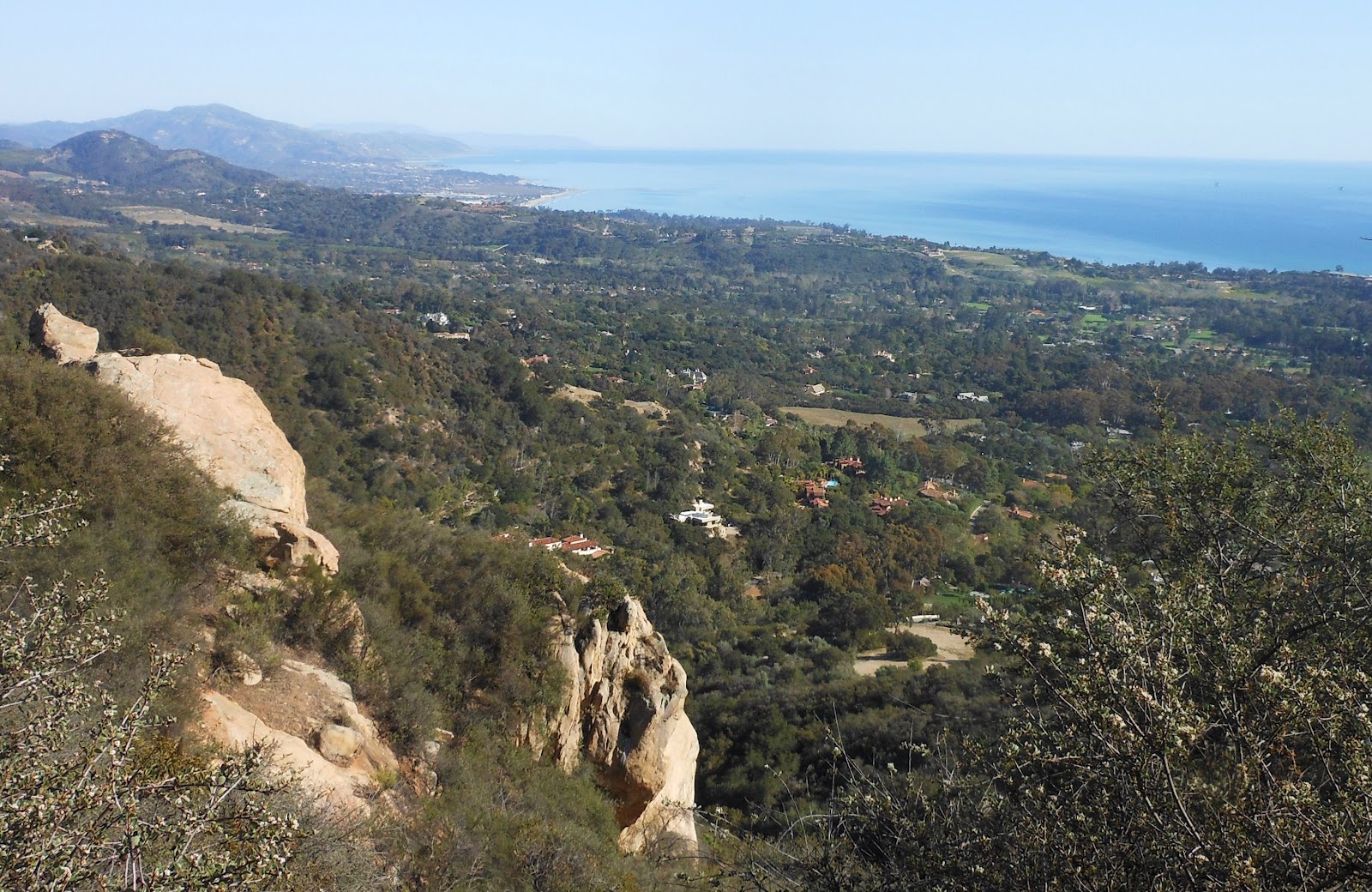
The Beach, beyond Faria County Park - Ventura, California

My Tripometer: 1.5 Hours * 1.5 Miles * +25 Feet


Directions:
From the 101 Freeway in Ventura, head North and exit at State Beaches.  Follow the Old Rincoln Highway for several miles past Faria County Park.  We parked in a new spot today between the RV's


 Hiking to the North - Leads to Ayden vs the Wave location

 A Pirate Ship to the right side of the island?

 An Island of birds in front of Santa Cruz

 Miles of RV's above the beach


We walked the beach to Faria County Park and turned back.  Jess forgot that Ayden had a soccer game at noon.  Good thing we got off to an early start...

Anacapa Island (took pic from drive home)


Day #477 Hike #538 * New Track #484
Monday March 5, 2012
Carpinteria Creek Park - Carpinteria, California

My Tripometer: 1 Hour * 1 Miles * +25 Feet
Directions:
Take the 101 Freeway North from Ventura and exit on Bailard in Carpinteria.  Turn right (away from the beach and the Seal parking.  Make an immediate left on Via Real.  Follow this around to the park.

We were originally going to see the seals but Ayden wanted to go to a park.  At the last minute, I drove around and found this place.  It's not the kind of park that Ayden was looking for; absent of jungles gyms and swing sets.  The place was quaint and we explored for awhile.  The creek area is overgrown and not really meant for trekking but we meandered with it for about a half mile, turned around and came back.

After about an hour here we immediately went to the Seals just before sunset.  We went in the easy way, about a half mile total thus it did not count as a hike... 


Day #478 Hike #539 * Duplicate Track
Tuesday March 6, 2012
Arroyo Verde - Ventura, California

My Tripometer: 1 Hour * 2 Miles * +425 Feet
After Ayden's soccer practice I took Sammi on a run through the trails in our backyard.  This was a quick workout before sunset.

Monday, March 12, 2012

Day 475: Lower McMenemy Trail - Girard Trail - San Ysidro Trail (Loop)

Santa Barbara Pier from the McMenemy Trail

Day #475 Hike #536 * New Track #482
Saturday March 3, 2012
Loop: Lower McMenemy - Girard - San Ysidro Trails - Montecito, California

My Tripometer: 2.5 Hours * 5 Miles * +1500 Feet


Directions:
Follow the same driving instructions from Day 462: San Ysidro Trail Waterfall  You will begin hiking along the same route for about a half mile and then once you reach the Lower McMenemy Trail, turn left and follow that trail...

 From the Lower McMenemy Trail sign, cross the creek

The uphill begins through the forest

 Looks like you can go left, possibly to a public street?
We turned right and continued to climb higher

 There will be a road on your left, but it ends.  Follow the switchbacks higher
The zigzags are not too difficult - if you don't take the cut thrus

 Take a rest, enjoy the view (there is more up to come)


 Rather than follow the Mcmenemy Trail, which appeared to go lower...

 We took the Girard Trail on the right to an immediate higher elevation


 There is a view point trail just off the main Girard

 Ayden ate his PB&J

 The trail eventually rounded to a road; We turned right to head lower

 Cross a little creek

 Rejoins the San Ysidro Trail (cool, we looped it!)
The single track takes you to the waterfall...

 Hmm, I don't remember this rock monster glaring at me last month?

Near the bottom, I climbed the rocks with Ayden!

What a great hike with great views.  I imagine that I will be back to this area at least a few more times to complete all sections.  From the Lower McMenemy Trail it appears that there must be another Trailhead.  I gotta go out and look for it...

Day 474: The Lakes and Civic Arts Center

Ayden on his ripstick at The Lakes, in Thousand Oaks

Day #474 Hike #535 * New Track #481
Friday March 2, 2012
The Lakes & Civic Arts Center - Thousand Oaks, California

My Tripometer: 1.5 Hours * 1.5 Miles * +25 Feet

Outside the Civic Arts Center

Directions:
From the 101 Freeway in Thousand Oaks, exit on Rancho or Hampshire.  Between these two exits on Thousand Oaks Blvd you will see the Civic Arts Center and The Lakes.

I took another early day from work and hung out with Jess and Ayden up here.  We walked around The Lakes, which is a shopping center with a few good restaurants.  In the summer time they have a guy renting out remote controlled boats, or maybe it's free.  I can't remember but being that its not even spring yet, there was not much action on these little toy lakes. 

We then decided to hike across the way to the Civic Arts Center.  It was a cool building with lots of walkways.  Of course, this became my hike for the day.  Why turn back, lets explore - it's a nice day.

Thursday, March 8, 2012

Day 1000: Mt. Whitney ** Hiking Trading Cards

...okay, so I'm not quite there yet but I am still going at it every day!  I figure that I should hit Day 1000 by late summer 2013.  --To help carry me through the next 500 days I've come up with an idea: 

HIKING COLLECTIBLE TRADING CARDS
I found a company that produces trading cards, typically for children's sports teams but they can print cards for anything, hence Hiking Trading Cards.  I am offering my First Series Collection for just $10.00.  The first series will contain 5 cards for five of my favorite hikes.  On the front of the card will be a Picture, Day# and Name of Hike.  On the back will be a smaller picture and description.  I have already lined up the printing instructions and will proceed with the order once I have a few sales.  I am not great at marketing so please pass word around and buy one for yourself.  All proceeds will go right back into this hiking adventure and the http://www.sealthebeach.com/ campaign.  The website is scheduled to come down on March 27, 2012 unless I raise funds to renew it.  Please show your support :)

Eventually I will set up a page with a legit order form but for now we'll have to do this the old fashion way.  Please write a check payable to Harbor Seals and Trails in the amount of $10.00.  Then send your check to:

Harbor Seals and Trails
1090 Gilbert Lane
Ventura, CA 93003

Please be sure to leave your return mailing address in the envelope with your check so I can send you the cards.

If you have any questions please feel free to contact me:

Cell: (805) 701-6123
Email: Jeremy@SEALtheBeach.com

Monday, March 5, 2012

Day 473: Santa Ynez Falls - Topanga State Park - Trippet Ranch

The Return of Bambi

***This is my Best Hike of the Year, so far :)***

 
Day #473 Hike #534 * New Track #480
Thursday March 1, 2012
Santa Ynez Falls Trail - Topanga State Park, California

Trippet Ranch
My Tripometer: 2.75 Hours * 6.5 Miles * +1350 Feet

Musch Trail to the left (not our trailhead on this fine day)

Directions:
From the 101 Freeway take exit 27, Topanga Canyon Blvd (SR 27) and head south towards the ocean.  Drive about 7 miles out of the populated area and into the mountainous region.  There will be a few small brown signs along the way that say "Topanga State Park".  Shortly before entering the town will be a mural wall on the left that says "Topanga".   You will turn left shortly after this onto Entrada.  If you reach the intersection and old town, you went too far.  There is no stop light for Entrada but you should see the brown sign for Topanga State Park.  Turn left on Entrada.  Follow the road to the left and keep following the signs and road to the left at every opportunity.  There is a small parking lot for the park (was fenced off) but keep driving until you reach the main parking area.  On the weekends it looks like you may have to pay.  Good deal for me; it was a weekday.  Park near the back and let's begin!

 Shaded picnic area - but who's having a picnic

 Taking the Waterfall Trail

 Follow the road up and then turn left at "The Latitude"

This is where I saw the deer that you saw in my blogpost feature picture.  From what I've read about this place, deer are common in this area.  They didn't seem to mind me much as they were posing while I took the picture.  Most deer run off, but these guys were just eating away.

 Veer to the right down the single track trail

 Amazing, Ocean views, Rocky Region - AMAZING!

I took this picture on my way back just before sunset

It's March 1st and I worked like a mad dog at the end of February.  I was dragging at work so I told them I needed to take off a couple hours early.  I dedicated this hike for all the hard work that I endured.  Thus, I figured to reach out a little bit further than normal during the work week.  It took me about 35 minutes to reach the trailhead today from Thousand Oaks.  It doesn't sound like much, but that's 35 minutes in the wrong direction which made my drive home about an hour and a half with traffic!

 easy downhill track - exposed to the sun, but the temperature was perfect

 Slight confusion, turn right and follow the main switchback down

 A whole new world down here

 beware of the coyote - camouflaged in the forest

 maybe this is Eagle Rock?

 a mountain lion den?

 this gray bushy haired squirrel needs glasses

 Trail junction, take the left fork

 2.2 miles in - cross the creek and turn left
the trail also goes right (I'm told it ends on Michael Lane near Sunset Blvd?)

 Heart Rock Tree

I read up on this trail and wore jeans because it was described with poison oak everywhere.  Well, I didn't see much and this "unmaintained trail" was in pretty good condition. 

 Crossing the notso creek many times

 Mr. butterfly landed in front of me for a sec, I snapped a pic and then it flew off

 Hmm, I can make a shirt out of this?

A trail goes up to the right, but...

The main attraction, The Waterfall, is just ahead along the creek.  But, we'll get to that in a minute.  See, I didn't know so I took the path higher...

 Narrow and steep incline

 Scrambling higher

the end?  Nope, bouldering to the right leads you higher


there are little trails between the rocks

Dangerous Bouldering - Not For Kids!


 take a breath of fresh air


Reaching to the top of the mountain...
A sign from the Moon - Domino!

I probably should not have even come this far, but I did.  I am not a big fan of bouldering - rock climbing.  At 220 pounds and 37 years of age, I just don't quite have the same confidence, balance and knees that I used to.  It honestly wasn't too hard to reach this spot, but being all alone, not a good idea.  So here I am, just 15 feet from the top of the world and I saw the way up.  I could have easily made it but then I saw the moon.  Every time I do, I think of Domino.  The day she died, I stepped outside, sat on the bench and the moon was the first object that I saw.  In between the tears I suppose that I hinted a smile.  --Domino was here today, warning me to not climb higher.  Consider, climbing higher is one thing but then you would have to get back down.  Going up is the easy part.  I chose to turn around at this point.  --Going down, confusing.  I lost my way and ended up higher than I needed to be in the wrong spot.  I obviously, eventually figured it out --I was tired and all of a sudden, it started getting late despite the earlier start.

Back at the bottom, should I explore the waterfall area?

 
Sure, climb rocks along the creek and keep going

lol, another Skyhiker Waterfall :)


Pink rope will help you higher
(I chose not too)

looking back at the rock canyon walls

The moral of the story is, this hike is actually very easy if you leave out the higher exploration.  Save yourself an hour and several hundred feet of climbing.  Of course, if I were to do it again, I would do it exactly the same way!  However, I would have left work at 1:00 not 2:00 to allow for even more time out here to explore...

On the way back, don't forget to turn right along the creek

I was in full jogging form.  The trail dipped into the dry creek for a half moment and then lifted back.  I saw the sign above and to the right out of the corner of my eye but it didn't register in my mind until a few strides later that I needed to go home that way.  This was almost a big oops! 

 
The Nature Loop

Nearly back to the car, take the Nature Loop as an alternative route past the Nature Center.  It's actually a short cut.  It will save you about 30 seconds :)

 
More deer near the trailhead

***I recommend this Hike for All***

Translate

ALEX'S LEMONADE STAND

ALEX'S LEMONADE STAND
Raising Money for Pediatric Cancer

RWANDA WATER HIKE

RWANDA WATER HIKE
Click Image to Learn More