Thursday, July 7, 2011

DAY 235: Simi Peak & China Flat

The summit of Simi Peak (Elevation 2,403 feet)

DAY 235: Simi Peak & China Flat
Date: Thursday July 7, 2011
Miles: 7.0
Elevation Gain: 1,450 Feet
Time: 2 hours
Difficulty: Steady uphill for 1+miles.  Dogs ok.  Kids, only if they have climbed before and it's not too hot!  
Reward: An Oak Tree Paradise and climbing the highest peak in the area!
Description: Push yourself up 1000 feet and then relax under the shade of the China Flat.  If you're up for it, climb another couple hundred feet to reach the peak.
Where: Oak Park, CA
Directions:From the 101 Freeway in Thousand Oaks, head south toward Los Angeles.  Just a couple exits up, exit on Lindero Canyon and turn left.  Drive about 4 miles and turn left on Wembly Ave.  Park immediately, walk back to Lindero and turn right.  The Trailhead will be on the right.  ***An alternate trailhead begins at the cul-de-sac on King James Ct.  This is the street before Wembly.  Although starting on King James will save you a few minutes, I refuse to step foot on a street named after a quitter basketball player.   Lebron, you are greatness but a true champion has a heart of a lion.  Good Luck finding your Yellow Brick Road...

usahiker.blog.com Day1: China Flat

Before there was calihike.blogspot.com there was usahiker.blog.com.  On the very first day of my hiking experiment, I began on this very same trail.  Due to time constraints due to an early sundown in November, Day 1 only lasted 3 miles.  Today I completed the mission:

 Trailhead (elevation ~1200 feet)

 Map

On Day 1, I took the side trail to the left once I reached the top.  Thus, Day 1 & Day 235 are different hikes.  In fact, I suspect there is a "Secret Way" to reach the peak.  I think I was on to something on Day 1.  Can anyone confirm this?

 Find your way to the top

 There is a face in this rock.  I swear that the ancient Chumash are spying on me
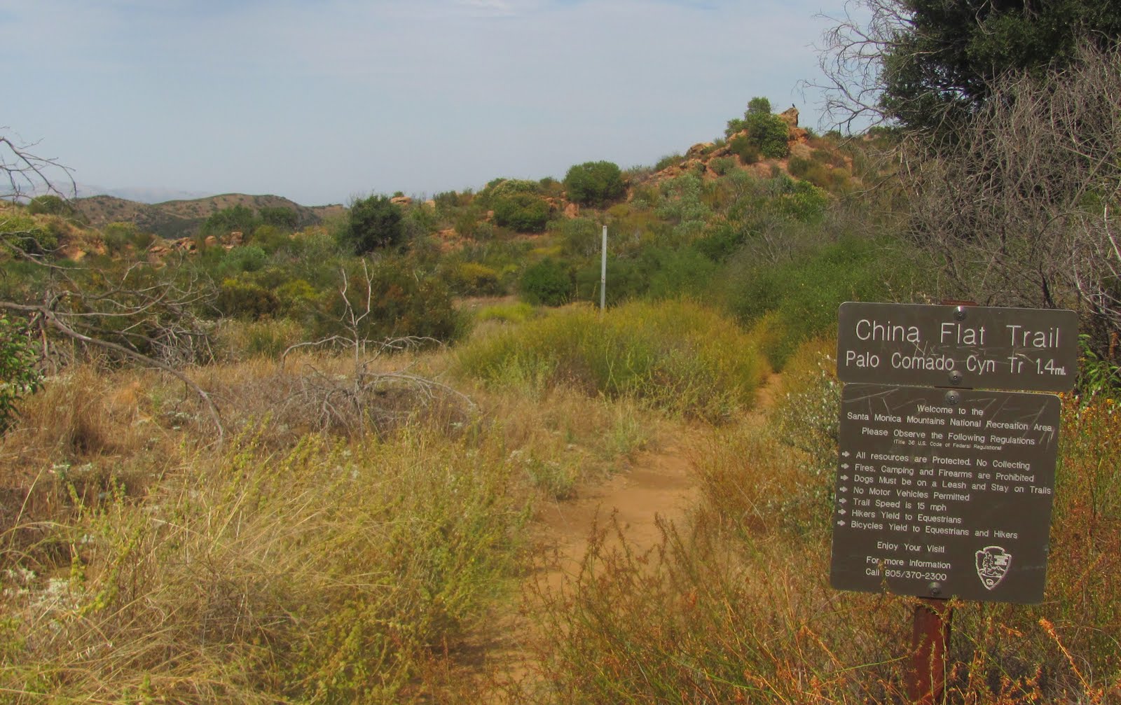
 On top, follow the main trail to the flat

 China Flat below

 An Oak Tree Paradise; this place is special

 To reach the peak, make a horseshoe U-turn to the left

 Simi Peak rises above to the left

You will reach a T-Junction at the end of the flat.  For some reason, I turned left?  I followed that a ways and nearly met up with where Albertson Road intersected the trail.  I was just out here the other day so I felt like I needed to connect the dots.  This added about 100 feet and 1 mile round trip to my totals.  I turned back and crossed to the other side of the junction.  The trail was overgrown and then lowered.  It felt wrong but before you know it, the downhill becomes a slow uphill through the thick.  It will eventually open up and reaching the top is very easy.
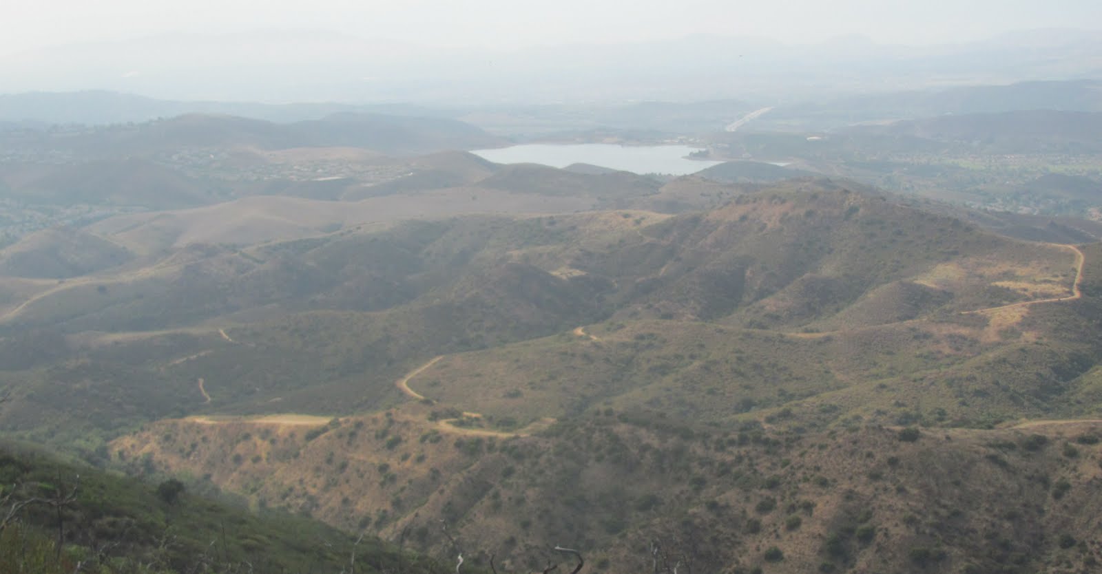
 Wood Ranch Reservoir (from the peak)

Albertson Fire Road travels up the first ridge from Lang Ranch Parkway.  Behind this road is the Autumn Ridge Trail (Day 51) .  It's pretty cool how all my hikes eventually link together! 

 Seal Treasure

Seal Treasures Game #4422.  What is the year listed on this plate?  To join the Seal Treasure game, please visit: SEALtheBeach.com  or Sealtreasures.blogspot.com
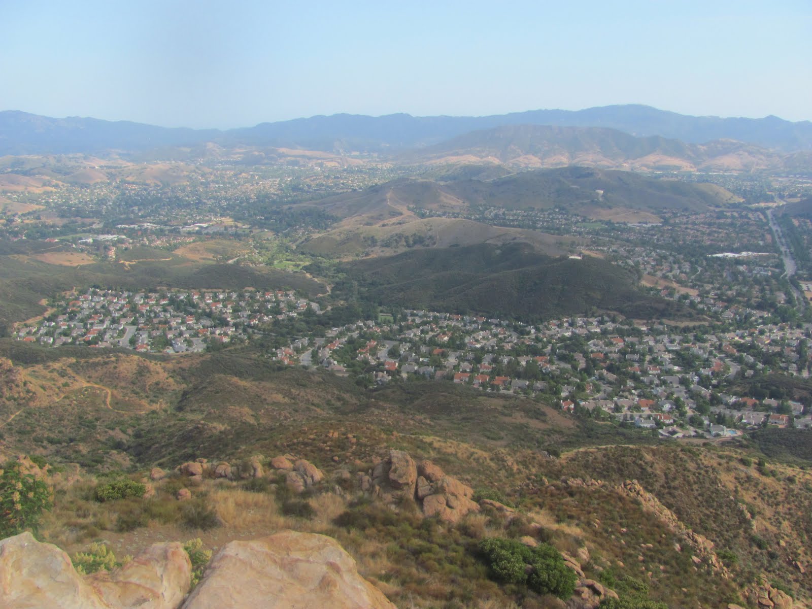
 Oak Park 1200 feet below

Albertson Rd & Simi Valley in the distance

The weather was a bit muggy, but the haze shielded the direct sunlight.  Unlike the past few days, today's weather in the Conejo Valley was tolerable for hiking.  The main downfall to this hike is that there is no running water.  It's always nice to trek along a stream.  You would think with the shaded Oak Flat there would be a water source.  Hmm, maybe there is on the far side.  I guess I'll have to take another trip up here.  Don't forget to sign in to the log book at the peak.  Ok, turn around and go home.  I jogged the entire way back; watch your step on the steep rocky hill...

Wednesday, July 6, 2011

DAY 232 - 234: Independence Day - Homeless Hideout


Day 232: Monday July 4, 2011
Secret Lookout: VC Fireworks


Total Hiking on July 4th: 6.5 miles +750 Feet; 1 mile + 150 feet on Firework Night Hike above Arroyo Verde, remaining mileage came at Arroyo Verde after dinner with Sammi

DAY 234: Homeless Hideout in the Santa Clara
Date: Wednesday July 6, 2011
Miles: 2.0
Elevation Gain: 50 Feet
Time: 1 hour
Difficulty: Easy,but you run the risk of encountering the homeless in no-mans-land 
Reward: Discovering the Drifter's hideout
Description: Take the 101 walking bridge over the Santa Clara from Ventura to Oxnard. Ventura, CA
Directions:From the 101 Freeway in Ventura, exit on Johnson and then park at the Motel 6.  The walkway to the bridge begins just past the end of the parking lot.

 Walking bridge along the 101, over the Santa Clara

My first visit to this area came on  Day 14: Ventura Barranca 
My November video featured Ayden riding his bike along the barranca and we ended up at my starting point today.  I went back one time since and ventured off toward the Oxnard side of the river, away from the bridge.  Today, my plan was to walk the river toward the ocean, but then I discovered the walking bridge.  So, I walked across with my son to Oxnard.  Rather than walking back, we jumped a wall and walked the river.  At first we hiked under the bridge but then we began to wander along the side toward the train bridge.


 Homeless Hideout

 Large wooden shack hidden in the thick

We followed a single tire mark into the thick.  I pried my head into a sheltered area and saw the cabin.  I thought about going in further, but then I noticed the tire resting by the entrance.  Quickly, I pushed Ayden away because I figured the tenant to this homeless paradise was probably home.  The set up wasn't bad.  It was well sheltered and probably dry from the rain.  It looked cozy.  The only real downfall is when it does rain, this river fills up.  Although I doubt it reaches the cabin level, there doesn't appear to be any other way out.  Well, I guess that's the chance you take living this way.  If this guy was smart, he would work a full time job and save his money.  Imagine not paying rent?  This guy could be a millionaire!  If you're going to be a homeless recluse, this is the way to live!

Train passed by as we were leaving

Day 233: Tuesday July 5, 2011
Albertson Road to China Flat: 6 miles +900feet 


I originally visited the China Flat area on Day 1, from Lindero Road.  More recently, I hiked along the trail known as Albertson Road when I became obsessed with the hidden Chumash Caves.  Today, my goal was to hike Simi Peak but after I reached the oak trees in the flat, I said "not today".  It was Hot, 90 degrees+ and I only brought one water bottle.  I jogged most of the +900 feet there.  The hill is gradual and gradually I drank all my water.  I will return to complete the mission!  

Monday, July 4, 2011

DAY 231: Missile Park, Pt. Dume, Hidden Malibu Beach & Legacy Park

Point Dume


DAY 231: Missile Park, Pt. Dume, Hidden Malibu Beach & Legacy Park
Date: Sunday July 3, 2011
Miles: 4.0
Elevation Gain: 150 Feet
Time: All Day
Difficulty: Easy day but the off trail at Pt. Dume is dangerous.  Protect your kids and NO Dogs
Reward: Sea Lions & a day with the family
Description: Another all day holiday weekend in Malibu
Where: Malibu, CA
Directions:From the 101 Freeway in Ventura County, exit at Del Norte.  Take this to the end and turn left on 5th Street.  Pass Pleasant Valley and then turn right on Wood (Look for the Pt. Mugu sign).  Wood ends at Pt. Mugu Missile Park at the PCH:

Missile Park, Pt. Mugu

We drove by it yesterday; today we stopped for a visit.  Fact: Pt. Mugu has shot off more missiles into the ocean than any other base in this country.

After our brief visit at Missile Park, we jumped on the PCH to head out of the June Gloom to reach the sunny beaches of Malibu California.  We headed back toward the popular Zuma Beach, where Baywatch was filmed.  Once again, traffic was backed up onto the PCH.  Turning right on Westward was impossible so we drove up to the next intersection.  Turn right on Heathercliff Rd.  Turn left on Dume Rd (across from the shopping center).  Follow Dume all the way to the end and then turn on Cliffside.  On the left you will see the Point Dume Natural Preserve.  There are only a few parking spots on the street up here.  Likely, you will not find a spot.  My wife dropped me off:

Trailhead off Cliffside Drive

Dume Cove

The trail to the left lowers to a secluded beach (Dume Cove as pictured above).  I took the trail to the right.  This will fork; the higher trail will lead you to an overlook.  You'll have to come back down and then follow the lower wooden walkway around Pt. Dume.  As I walked this path, I heard Sea Lions:

Sea Lions on the rocks below

 Climbing Wall separating the Beach


 Private Cove below

 Pt. Dume Beach extending to Zuma

The plan was for me to hike around Pt. Dume and then meet the wife in kids somewhere along the beach.  After leaving the hiking trail, I began to jog the pay parking area for Pt. Dume, which was full.  I then trotted between traffic on Westward and eventually found my wife stuck in traffic.  Unlike yesterday, the secret was out and there would be no possible way to park, period!

My round trip covered 2+ miles over 45 minutes of time.  I spent a good deal of time hiking off trail to the top of the rock where daring enthusiast were rock climbing.  I took the easy route, one step over the roped trail and an easy hike to take in some spectacular views.  Sea Lions, really!!  It was worth it...

 Malibu Hills

We drove south along the PCH in search for a less populated beach.  The picture above represents one of the homes that I will buy when I am done hiking.  Until then, in search...  Passing Peperdine, we turned right on Webb.  Immediately after turning right, we turned right again.  The Malibu Bluffs were up on the right and we passed a few side trails.  I hiked the bluffs on Day 119  from the main entrance off PCH.  From Webb, we found a small public beach about 1.5 miles down.  Even if we hadn't found a beach for the kids, the homes were cool to look at.
 
 Jessi taking the hard way down (there are stairs)

 Police ticketing for open containers and dogs with no leashes

 Diverting sewage water along the Jacobus River


Hungry anyone?  After a long day at the beach, we drove up a few blocks and turned into the shopping center.  The Malibu Country Mart is a nice touristy place to shop, eat and hangout.  We spent hours there playing freeze tag with other kids.

 Legacy Park

There is a hiking walkway that joins the Country Mart.  We walked across the way and it lead to Legacy Park.  This fine dirt trail circles the meadows.  If you're lucky, you may see an owl.  We could have followed this across the PCH and down to another beach, but maybe some other time.  We drove back near sunset.  Once again, the June Gloom stayed north and never did taper off.  Look at how the light formed a horseshoe through the clouds...


Rewind:

Day 229: Friday July 1, 2011
Harry A Lyon Park 2.0 miles +100 feet

This is not a desirable place to go to.  That said, the softball fields are nice.  I played a few games here when I was in a traveling league a year ago.  More recently, I hiked outside this park on Day 76: Avenue Trail.  I came here today with Domino.  My wife has been taking Sammi to the dog park so I wanted to take Domino somewhere new, alone so we could go at her pace.  This old dumb dog still wants to chase a cat like a little puppy, until she realizes her back legs give out, which make her flip.  As far as I can tell though, she is doing ok!  I took her up into the hills beyond the park, where the homeless live.  She was doing ok.  Once Domi starts chugging along, she's all good!

***Forward Looking  
Happy Independence Day.  Today will be Day 232.  We spent much of the afternoon out at our pool.  I am so over the water and so red from this crazy long weekend.  It will be a relief working in an air conditioned office on Tuesday.  I say that now, but after a few hours I know I'll want out.  Anyhow, I have a hiked plan to see the Firework Show later.  I'll write that up manana...

Sunday, July 3, 2011

DAY 230: Great Sand Dune, Nicholas Flat & Zuma Westward

From atop the Great Sand Dune!


DAY 230: Great Sand Dune, Nicholas Flat & Zuma Westward
Date: Saturday July 2, 2011
Miles: 5.5
Elevation Gain: 750 Feet
Time: All Day
Difficulty: The Sand Dune is very steep, It was very hot and I went the wrong way at Nicholas Flat
Reward: Sliding down the Great Sand Dune & Dolphins at the refreshing Zuma Westward Beach
Description: All day holiday weekend in Malibu
Where: Malibu, CA
Directions:From Ventura County, make your way to the PCH (via Las Posas or Rice Road from the 101).  Because the Rice Road ramp is currently closed, we exited at Del Norte, turned left on 5th and turned right on Wood.  Wood ends at Pt. Mugu Missile Park at the PCH; get on and go towards Malibu.  First stop, the Great Sand Dune.  This will be on your left about 5 miles up (you can't miss it)...

Looking back at Mugu Rock

June Gloom on July 2nd; typical.  At least in Malibu you can see the sun.  From my house in Ventura, the ocean looked like a cloud of smoke.  It made me think of the Mistake on the Lake (when lake Erie and the Cuyahoga River caught fire).

The sand on the dune was quite deep, so walking up to the top was not easy.  Slow, steep & deep footsteps climbing up around 100 feet.  Think you'll slide down this hill like a sled in snow, think again.  Not possible.  Instead, I ran down and pulled Ayden on the boogie board.  Only problem was, my feet were kicking sand up in the air and he was literally eating my dust.  Eventually, he let go and with the instant loss of weight, I went flying.  I took a tumble, hit my arm against a rock and landed with my face in the sand.  I survived, so did he :)

**Next on our holiday shopping list will be a short hike to Nicholas Flat.  From the Great Sand Dune, continue south on the PCH.  Another 5 miles or so turn left on Decker Canyon Road, Route 23.  Drive up a few miles, around 1500 feet of elevation.  Look for the sign on the left for Decker Camp Grounds.  Keep going another quarter mile and then turn off to the left onto Decker School Road.  This street can be hard to see.  As the 23 swerves a turn to the right, Decker School Road will be nearly straight ahead over a hump.  Be mindful of traffic that you cannot see coming downhill.  Once on Decker School Road, take this all the way to the end and park:

 The Trailhead

There are two trailheads.  My goal was to hike to a small lake so I ventured down the trail on the left.  According to the map, this would be a short 0.3 mile hike and then loop on a pretty level flat area.  At 1500 feet, the June Gloom was completely burnt off and the temperature was over 90.  The wife and kids wanted to stay in the car which allowed me to run the trail.  I should be back in 20 minutes...

 
As you can see by the orange highlighted route that I took; I went the wrong way.  At the junction 0.3 miles in, I was supposed to turn right but instead I kept straight.  I ran down the open run under the bright sunlight.   I probably ran down 300 feet until I said, forget about it.  I hiked back up and then took another split to the right (which lead me further away from my destination).  Still, I was hopeful that I was going to find the lake so I ran down this hill about 200 feet until I said, forget about it.  It wasn't until after I came back to the car, 45 minutes later, that I realized I went the wrong way.  I ran so hard that I felt like I was going to puke, but I didn't.  Here are some pictures:

 A cool shady start to my jog

 The turn I missed

The only problem with jogging is, you miss the little things; Like Small Hidden Signs!  I snapped this picture on my exhausted was back.  Before I wandered into the wild, I looked at the map and was expecting this junction at 0.3 miles in.  For some reason, I thought I was supposed to go straight...

 Into the open under the hot sun

 Nicholas Road after dropping a couple hundred feet

 Decker Canyon Road off to the left

At this point I realized that the trail is only going to keep going lower.  So, I turned back.  Rather than quit, I then went up a junction that I had passed earlier.  However, that road then started going lower.  Hmm, maybe the lake is down here?:

 ...No lake, just a house in the middle of nowhere

 Turn around, climbing back up again!

 A long hot jog back...

Nicholas Flat ahead

Of course, I didn't turn down the skipped trail.  I probably should have.  According to the map, the lake would have been less than a quarter mile away!  You know what, I will be back.  I did not see one other person in this area.  I never heard of this area before.  It was only by chance that I bought this map and discovered what should have been a short, easy family hike.  --The day is not over yet, let's head back to Malibu:

 A car in the ditch at the end of Decker Canyon Road

 The ambulance had just pulled away


Lady Surfer wearing a wetsuit, high heals & a motorcycle helmet

The beaches were packed on this hot holiday weekend.  Although June Gloom remained at Leo Carrillo all day, just a few miles south the sun burnt off the misty layer.  We stopped at Starbucks on the corner of Trancas Canyon Road and PCH.  Instead of paying for parking at one of those popular, overcrowded beaches, we searched for a local private beach.  Across from Trances Canyon Road is Broad Beach Road.  We drove down the narrow residential street and found beach access:


Ayden was attacking me with his boogie board.  --This beach was no good because it was nearing high tide.  A local resident said that it would be low tide at 8:00 pm; yeah, we are not waiting.  So, we drove further down the PCH and just past Zuma Beach and Busch Road, turn left on Westward Beach Road.  While cars were lined up at the pay gate at Zuma, which created a backup on the PCH, we drove down Westward and found a spot on the street for free.  It took a couple of back and fourths but once there, we were in paradise.  Unlike some of the other beaches, the sand was not overcrowded and we had plenty of room to do what we do.

 Zuma Westward FREE Beach


Alyssa went boogie boarding while Jess and I played football.  My girl has an arm and caught most of my passed.  Meanwhile Ayden was building sandcastles, something he used to do when he played T-Ball.  --There were about 10 dolphins in sight the entire time.  They kept swimming back and forth.  We took the kids to see "Sole Surfer" the night before, a movie where a kid surfer lost her arm from a shark attack.  Fortunately, that did not deter our kids from going in the waters, even with circling dolphins.  At one point, the dolphins were racing and jumping waves.  The picture below shows how close they came to Alyssa.  I was using my camera phone so the resolution is blury, but those four humps over Alyssa's head are dolphins!


Ayden finally made it in the water and rode the waves.  A perfect day in California; can't wait to do it again!

Translate

ALEX'S LEMONADE STAND

ALEX'S LEMONADE STAND
Raising Money for Pediatric Cancer

RWANDA WATER HIKE

RWANDA WATER HIKE
Click Image to Learn More