Sunday, March 24, 2013

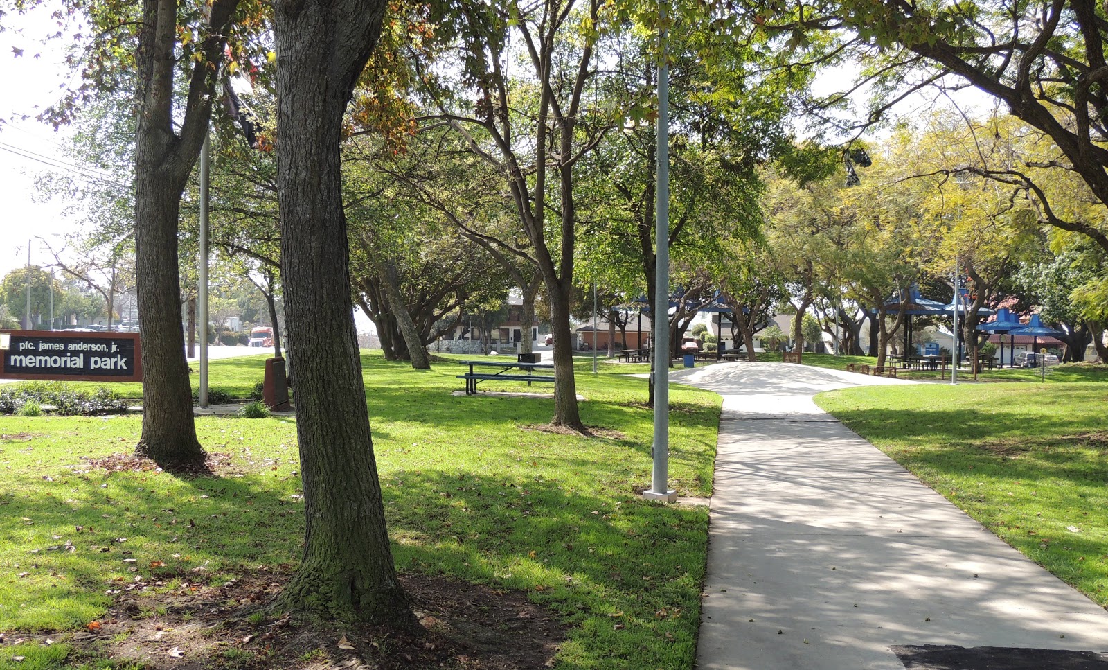
Day 857: PFC James Anderson, JR. Memorial Park

Day #856 * Hike #1065 * Duplicate Track
On Thursday I woke up with a sore throat and no voice!  I thought I dodged the bug that has been going around but finally it caught up to me.  I called in sick from work that morning and began updating my awesome hike from the weekend: Day 852 Big Caliente Hot Springs.

Maybe I was just completely exhausted from working, hiking and then closing at Chill Out.  In any event, later that morning I took my dogs on a duplicate hike around Arroyo Verde and then sucked it up and went to work.  After work, I went to Chill Out and worked till nearly midnight.  So tired...

Friday Morning, I was even more sick than I was on Thursday so I took the entire day off.  No point working on the phone when you can't talk!  However, I took the opportunity to drive down to Long Beach and pick up our www.ChillOutFrozenYogurt.com menus from my sister.

Sammi came along with my for the long ride.  After my brief visit and menu exchange, I took her for some exercise at this park:


Day #857 * Hike #1066 * New Track #836
PFC James Anderson, Jr. Memorial Park - Carson, California
Friday March 22, 2013
My Tripometer: 0.5 Hours * 1 Miles * +0 Feet


 Corner of Wilmington Ave & E. University Dr. in Carson


This was a small park on a busy corner but Sammi got to stretch her legs, and so did I.  After accumulating a mile, we jumped back into the car and we began our pursuit of finding some awesome new trails nearby.  Stay tuned...

Saturday, March 23, 2013

Day 855: Ormond Beach Area - Arcturus Trail


Day #855 * Hike #1064 * New Track #835
Ormond Beach Area - Oxnard, California
Arcturus Trail

Wenesday March 20, 2013
My Tripometer: 0.75 Hours * 1.25 Miles * +25 Feet


 Trailhead
Between all the pollution of South Oxnard, there is a protected preserve...

Directions:
From Hueneme Road near Saviers, head down Arcturus road, past the industrial to the end.  Turn right and park at the end as seen in the picture above.  This is essentially private hoboland, so it's not a recommended hike.  However, it was crucial that I hiked here at some point, and today was the day.  I've hiked to the beach on either side as seen on:


Wildlife to the left, but I followed the road

 **I wonder what this area will look like 100 years from now?

 Okay, so I decided to cut through here...

 Warning, Chemicals?  **It did smell nasty...

 That's one big boat...

pollution...


 Zoomed in, that's where I started from

 this is the way I'm going...

 Home...

 Beach, Boat & Anacapa

 Hueneme Pier


Overall, pretty cool spot!  It was stinky, I probably shouldn't have been here but don't we have coastal access rights?  Isn't this the reason that we are able to walk by the seals during the off season?  Hey, did you hear about what some people were doing to the seals in La Jolla recently/.  Yeah, kicking them and stuff.  Horrible!  What's wrong with people.  Yeah, so I may have been on private property but I am not harming this area.  I am cherishing it forever!

Day 854: Ray Miller Trail - First Leg of the Backbone Trail - La Jolla

La Jolla Valley - from the Ray Miller Trail

Day #854 * Hike #1063 * New Track #834
Ray Miller Trail - First Leg of the Backbone Trail - Malibu, California
Tuesday March 19, 2013
My Tripometer: 1.25 Hours * 6 Miles * +1000 Feet


Directions:
From Ventura County, head out to the PCH and turn left into the La Jolla parking area across the street from Thornehill Broom Beach.  However, instead of paying $8.00 in the self pay lot, you can park out on the PCH for free!!!

 Down the road: Day 230: Great Sand Dune
 
 jog 0.2 miles to reach the trailhead

The Ray Miller Trail is aka the First Leg of the Backbone Trail.  Although there is no indication on the trail sign, you should feel honored and privileged that you will be hiking this well known route.

FYI, there is another, more pleasurable and easier trail located in this parking area: Day 70: La Jolla Canyon.  If you are up for a long 7.5 mile loop, you can weave the Ray Miller Trail and La Jolla Trail together.  For today, I'll be taking the 2.7 mile track out and back...

Backbone Trailhead...

The Map
 
 Very Nice - Fast Trail!

 Very Gradual Climb
 
 Ocean Views

 Looking down on the snake of the Backbone and Mugu Rock

 La Jolla Valley: Hiked there on Day 216: La Jolla Valley
(Completely Amazing and Free back here!)

 Heading into the marine layer...

 Made it to the Fire Road

 Looking right down the Fire Road - Heads to Sycamore Canyon

The Backbone continues left along the road.  You would go left to loop back down La Jolla.  I figure that I will return up here on a bike from Sycamore and expand my trek across the Backbone.


With my camera in hand, I turned around and began to run.  Yes, run, not jog!  I ran so hard that my watering system broke!  The strap to one of my 10 ounce holders broke so with my free hand, I held on to my water.  Crazy, I hiked last week and went through water like water.  Today, I started with 20 ounces of God's Juice and ended up with about 18 ounces.  It only took me 20 minutes to run the 2.7 miles back, plus the 0.2 to the car.  Insane!  The faster I ran, the faster I wanted to go.  I'm not sure what got into me!  What a great trail!


Day 853: Hobo Lobo Canyon Trail - Filming the Bachelorette

Bachelor House

Day #853 * Hike #1062 * New Track #833
Hobo Lobo Canyon Trail - Agoura Hills, California
Filming the Bachelorette
Monday March 18, 2013
My Tripometer: 1.5 Hours * 1.5 Miles * +100 Feet


 is this Des talking to her potential fiance?

 Will this guy get a rose?

 Who are these women?


 This guy kept jumping in the pool...

 see...

 the backyard...

 the pool

 scouting out from another location

 new hike here, but...

 Hobo Lobo Canyon Trailhead...

I searched around to find a new, higher vantage point.  From the last spot, I could have essentially walked right up to the wall.  It would have been a scratchy push, but it would have been possible.  However, that's insane, so is this whole situation.  So, I rode down Triunfo road to see if there was some way to climb the back hillside.  This could possibly give me another vantage point with my 42 Times Zoom...

Directions:
From Kanan, turn down Triunfo, pass Lobo Canyon and then look for this little trail on the left.  There are a couple of other ways to head up this hillside as well.  Triunfo ends shortly after this trail, but here goes...
 Looking back; so far so good...

 Junction; I go Left
 
Woah, Hobo Wasteland behind the Multi Million Dollar Homes!

Sketchy...
 
I turned back from hoboland.  I then tried the other trail and got to this point in the picture above.  Okay, this is Stupid!  I covered a mile plus today, I'm over it, head back...
 
One more shot, from Kanan
(Bachelor House above to the left)

***Zoom Zoom... Time to ride over to Chill Out Frozen Yogurt...

Translate

ALEX'S LEMONADE STAND

ALEX'S LEMONADE STAND
Raising Money for Pediatric Cancer

RWANDA WATER HIKE

RWANDA WATER HIKE
Click Image to Learn More